
Presentation
Theia Soil Moisture at Very High Spatial Resolution Scientific Expertise Centre (SEC) brings together teams from UMR Tetis and Cesbio that develop mapping of soil moisture with precision and spatial and temporal resolutions that are suited to the needs of the users: scientists and players responsible for public policies.
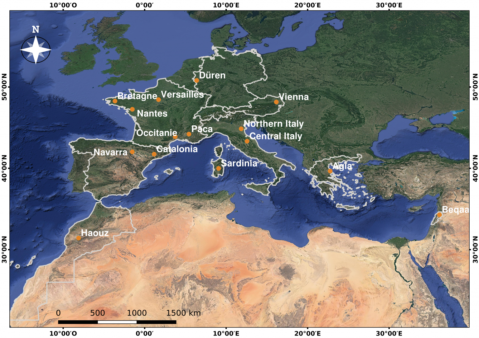
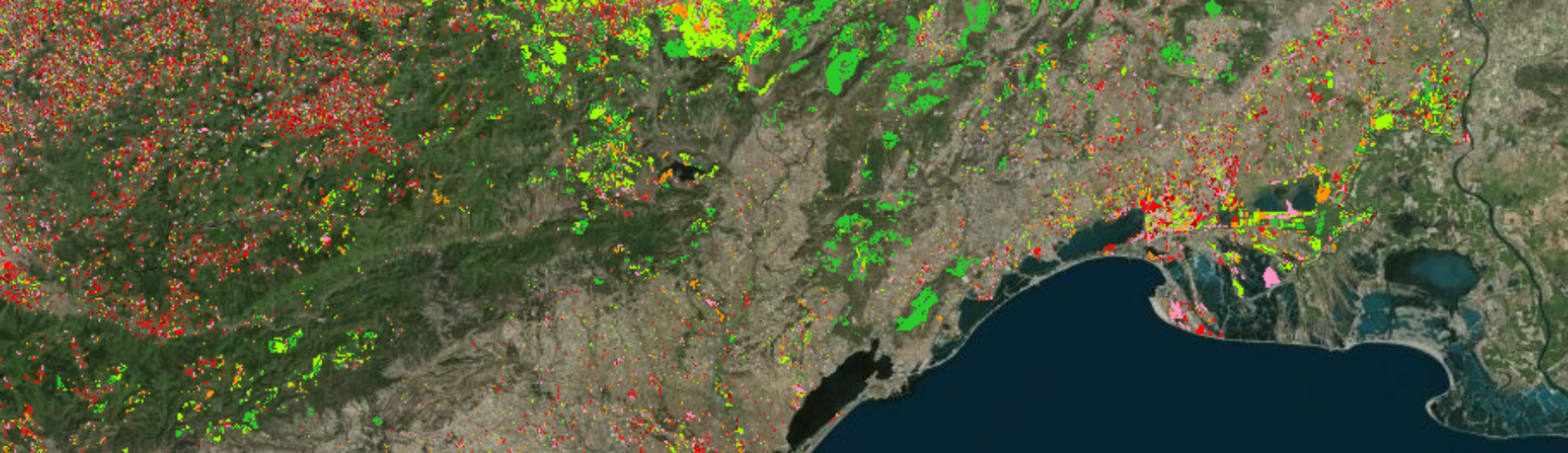
The product resulting from the soil moisture with very high spatial resolution SEC is updated with a frequency of six days. It has a parcel and intra-parcel scale, from 0.2 hectares upwards, and covers various sites around the Mediterranean basin and elsewhere in Europe.
The data used come from radiometrically and geometrically corrected Sentinel-1 and Sentinel-2 HR image series.
Data at plot level with high repetitiveness
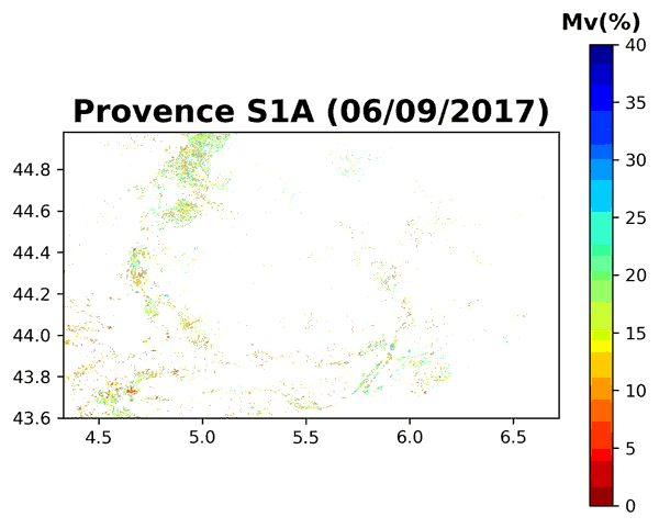
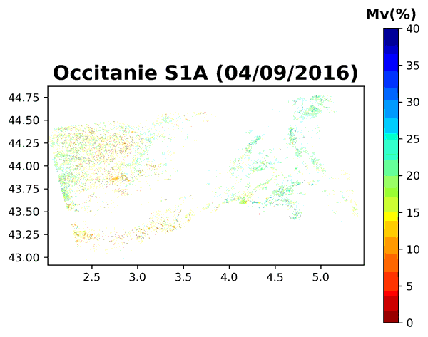
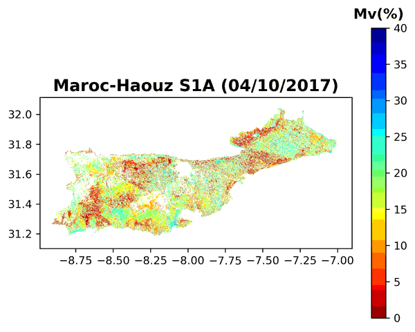
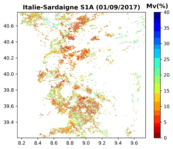
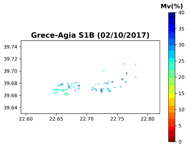
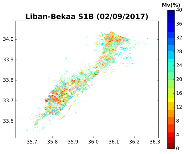
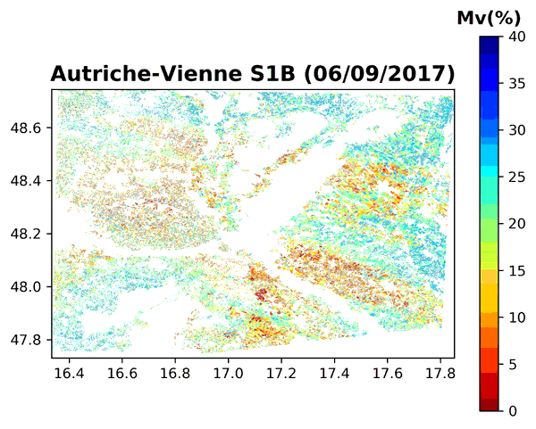
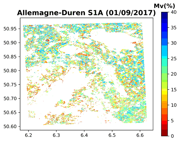
Some examples of Soil Moisture Data series
Schedule
- 2017: demonstration products using Sentinel 1 and Sentinel 2 / Landsat 8 over limited areas (Occitanie and Tunisia)
- 2018: development of an operational production chain
- 2018-2019: production at numerous sites in France, Europe and around the Mediterranean in one of Theia’s IDS.
- 2019-2020 : ● Continue production ● Continue analysis on the accuracy and validity of estimates ● Use moisture estimates for mapping irrigated plots ● Analyze complementarity with band data
Contact

Nicolas Baghdadi
INRAE | Tetis
ResearchGate
Contributions

Mehrez Zribi
CNRS | Cesbio
ResearchGate
@M.Zribi
Contributions