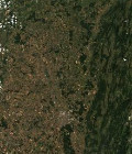
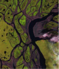
All the SPOT5 (Take5) images are now available

The Theia team completed the processing of SPOT5 (Take5) level 1C and level  2A data.

The time series are now available for download on the server : https://spot-take5.org

Nearly 3000 level 2A products are available, and even more level 1C, as issue the Level 2A product are only issued when the cloud and snow cover is below 90%.

Globally, the L1C and L2A have a good quality, even if we spotted a few issues and are thinking of a reprocessing.

More information on https://labo.obs-mip.fr/multitemp/?p=5883

More information: 

More news

Two THEIA LiDAR tools for forest monitoring

On this International Day of Forests, for which innovation has a major role to play in 2024, we are highlighting two tools dedicated to the management of aerial LiDAR data […]

SWOT data that exceeds expectations

The SWOT space mission was launched at the end of 2022 by CNES and NASA to document the water masses of the entire planet – oceans and continental waters. Data […]

Albédo Sentinel 2 THEIA pur l'Île-de-France, juin 2022

Measuring the albedo of mainland France from Sentinel-2

THEIA’s Albedo team has developed a method for calculating high-resolution (HR) albedo using Sentinel-2 data. The method has already been used as part of the Copernicus Global Land Service program, […]

Search