Two THEIA LiDAR tools for forest monitoring
On this International Day of Forests, for which innovation has a major role to play in 2024, we are highlighting two tools dedicated to the management of aerial LiDAR data […]
Tools elaborated in Theia SECs.
On this International Day of Forests, for which innovation has a major role to play in 2024, we are highlighting two tools dedicated to the management of aerial LiDAR data […]
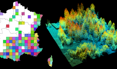
Tool access The R package lidarHD is available at https://forgemia.inra.fr/lidar/lidarHD. A tutorial is available at: https://lidar.pages.mia.inra.fr/lidarHD/articles/lidarHD.html Presentation lidarHD contains tools for downloading and managing files from the French LiDAR HD […]

lidaRtRee is an R package that provides functions for forest analysis using airborne laser scanning (LiDAR remote sensing) data:
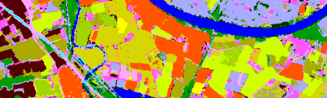
Tool Access Presentation Iota2 – Infrastructure for Land Use by Automatic Processing Incorporating Orfeo Toolbox Applications is the name of the renowned land use map production chain developed at CESBIO […]
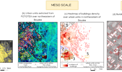
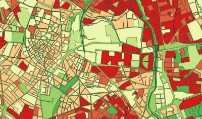
FOTOTEX, developed within Theia Risks Associated with Infectious Disease Risks and Urban SECs, proposes a unique, rapid and unsupervised method for characterising urban areas at three overlapping scales.
Software able simulate the population dynamics of Aedes albopictus and Aedes aegypti.
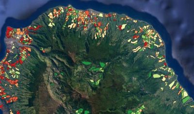
Software enabling to simulate the population dynamics for tiger mosquito, Aedes albopictus, Reunion Island
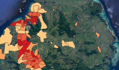
Software to simulate the population dynamics of the tiger mosquito, Aedes albopictus, in Mauritius.
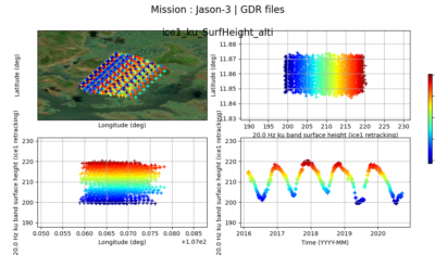
The AlTiS software allows the visualisation of altimeter data and the creation of water level time series on rivers, lakes and flooded areas.