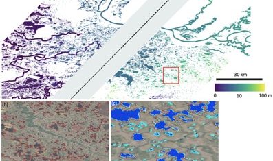
SWOT data that exceeds expectations
The SWOT space mission was launched at the end of 2022 by CNES and NASA to document the water masses of the entire planet – oceans and continental waters. Data […]
The SWOT space mission was launched at the end of 2022 by CNES and NASA to document the water masses of the entire planet – oceans and continental waters. Data […]
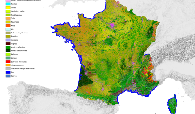
THEIA Land Cover product is produced each year by CESBIO and CNES. It provides a 24-class typology of land cover, downloadable by department for mainland France. Production begins in January […]
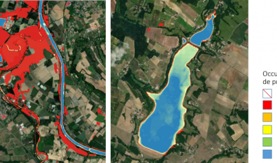
Discover Theia Surfwater Product now produced continuously for Sentinel-2 and available on hydroweb.next
Discover the new hydroweb.next portal, which now include Theia Lake and River Water Level Products, Hydroweb
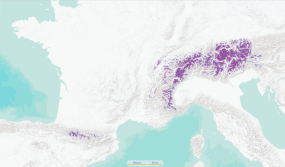
Find Theia Snow product on hydroweb.next along with other signifiative hydrological data and products.
Data Access Description At the end of 2022, the SWOT satellite (NASA-CNES) will enable global monitoring of water resources on continental surfaces. Its two radar antennas and interferometric processing capabilities […]
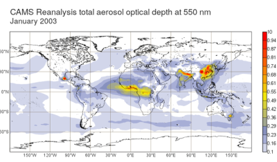
From the end of September, the MAJA processing chain will be using CAMS 48r1 data for the production of Theia Surface Reflectance products.
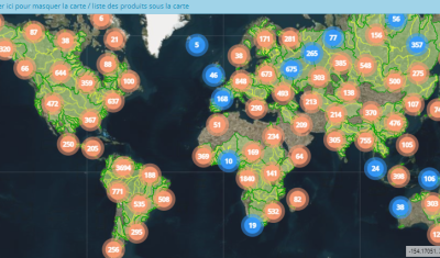
The database Hydroweb offers River Height and Lake Height products derived from spatial altimetry. These time series provide the height of rivers and the height of lakes and reservoirs around the world […]

Like every year at this time, you’re invited to discover the new version of the OSO product, from the S.E.C Land cover. The 2022 version was released a few days […]