Monitoring Lake and River’s Water Level: Sentinel-6A’s turn
Hydroweb product continuity is already ensured with the integration of Sentinel-6A data in place of Jason-3.
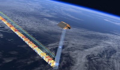
Hydroweb product continuity is already ensured with the integration of Sentinel-6A data in place of Jason-3.
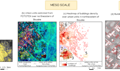
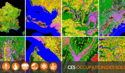
FOTOTEX, developed within Theia Risks Associated with Infectious Disease Risks and Urban SECs, proposes a unique, rapid and unsupervised method for characterising urban areas at three overlapping scales.
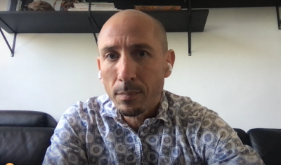
Meet with Jean-François Faure, one of Theia’s founding fathers and active facilitator of Theia activities in the global South as well as the national secretary of the DINAMIS mechanism.
The SCO facilitators discuss the Space Climate Observatory project, through which several THEIA SECs and RANs projects have been labelled.
Thanks to the optimisation of the production by the SEC team, all (or almost all) series documenting soil moisture at the plot level are available at least until August 2021.
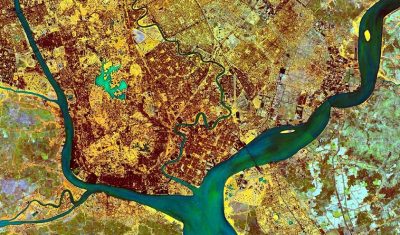
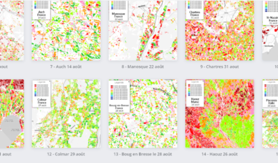
The 2020 edition, which was slightly later than the previous ones, is now available with its 23 land cover classes for Metropolitan France and “refined” natural classes.
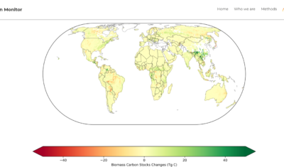
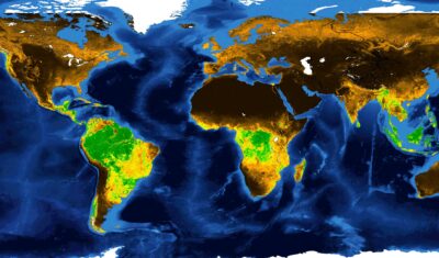
Discover the Biomass Carbon Monitor. Based on SMOS data, it provides a comparison tool for forest cover and carbon sequestration trends at global scale.
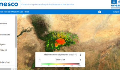
Theia Colours of the Continental Waters SEC has produced with Magellium a demonstrator based on data from the Lake Chad portal on the quality of continental waters.
The GEOV2-AVHRR product has been updated for the year 2020. There are now 39 years of global vegetation change data available.