Prototyping SEC

Theia Prototyping SECs currently propose a small-scale production on geographical and temporal areas in order to demonstrate the interest of the products to the community and to finalize their qualification.
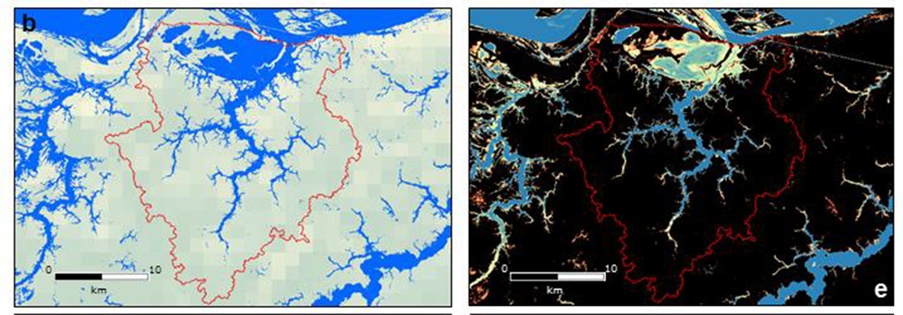
  • CES (8)

Prototyping SEC

Vegetation biophysical variables SEC

Mapping vegetation biophysical variables on a global scale.

Prototyping SEC

Surface water volumes of floodplains SEC

Mapping water level on rivers and floodplains in order to calculate the volumes of water stored at the basin scale.

Prototyping SEC

Glaciers SEC

Measuring the Annual Equilibrium-Line Altitude at the end of the ablation period by spatial optical remote sensing

Prototyping SEC

Urban SEC

Mapping artificialized surfaces, urban fabrics, urban vegetation, changes and indicators.

Prototyping SEC

Evapotranspiration SEC

Mapping evapotranspiration, especially on agricultural land.

Suspended matters concentration map obtained by Sentinel-2 imagery at the confluence of the Amazon and Negro rivers (Brazil)

Prototyping SEC

Colours of the continental waters SEC

Assessing the concentration of suspended solids and chlorophyll-a in surface waters of rivers, lakes or estuaries.

Prototyping SEC

Digital Soil Mapping SEC

Mapping the sustainable properties of soils for scientists and public policy actors.

Prototyping SEC

Forest biomass and changes in forest cover SEC

Mapping of above-ground biomass (in tonnes/ha) of forests as well as changes in forest cover following deforestation and forest degradation

Search