
Presentation
Theia Fire Scientific Expertise Centre (SEC) brings together teams from INRAE, ONF, Sertit and CERFACS that develop early mapping of the outlines and intensity of forest fires, interface fires and damage to vegetation. The users are land managers and fire risk managers, firefighting services.
Three main products are available:
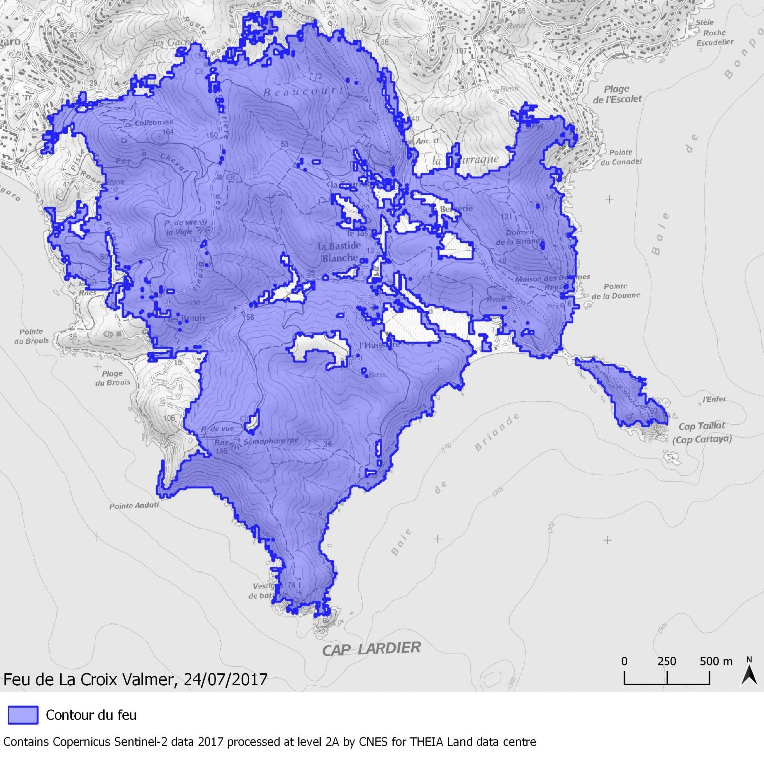
Fire Contour Map > 100 ha
Based on dNBR, this map delineates the major fires (over 100 ha) for France since 2017.
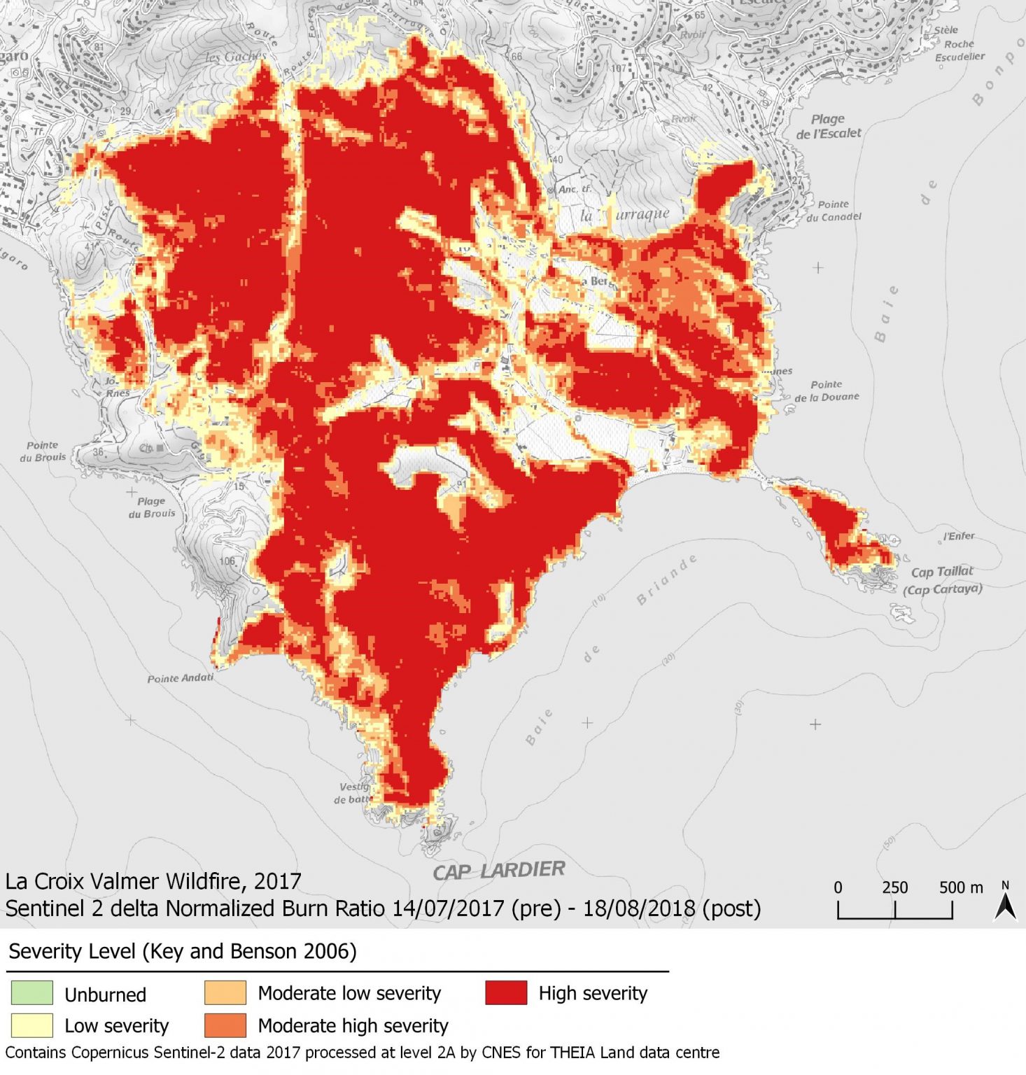
Fire Severity Level Map
Maps are available for 2017, 2018 and 2019 to document for each wildfire the 5 severity levels defined by Key & Benson (2006).
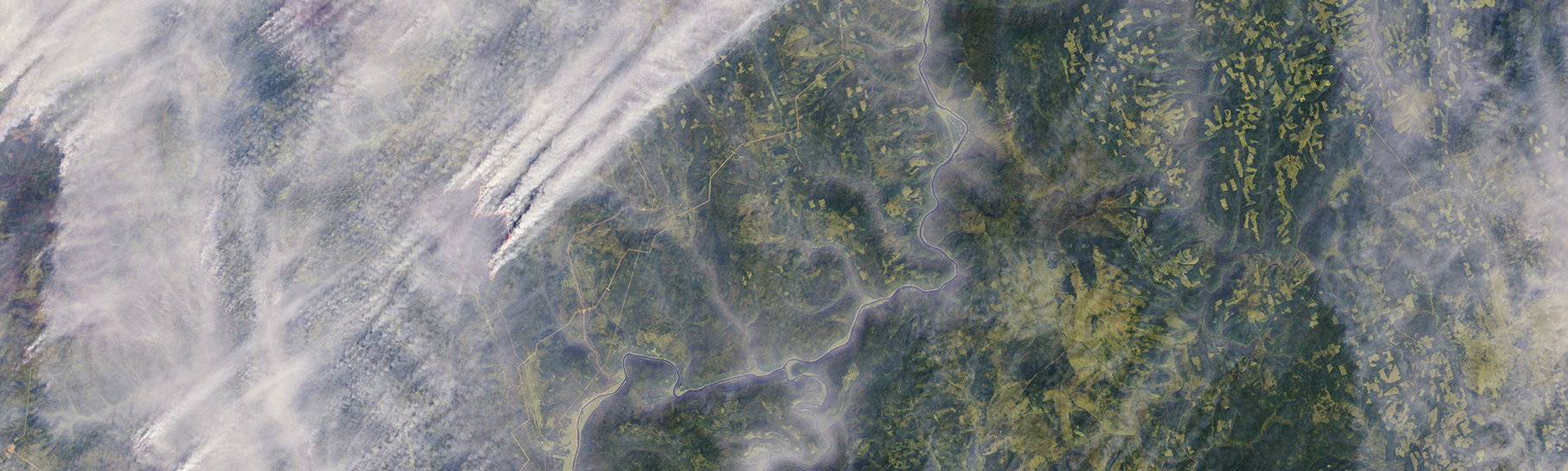
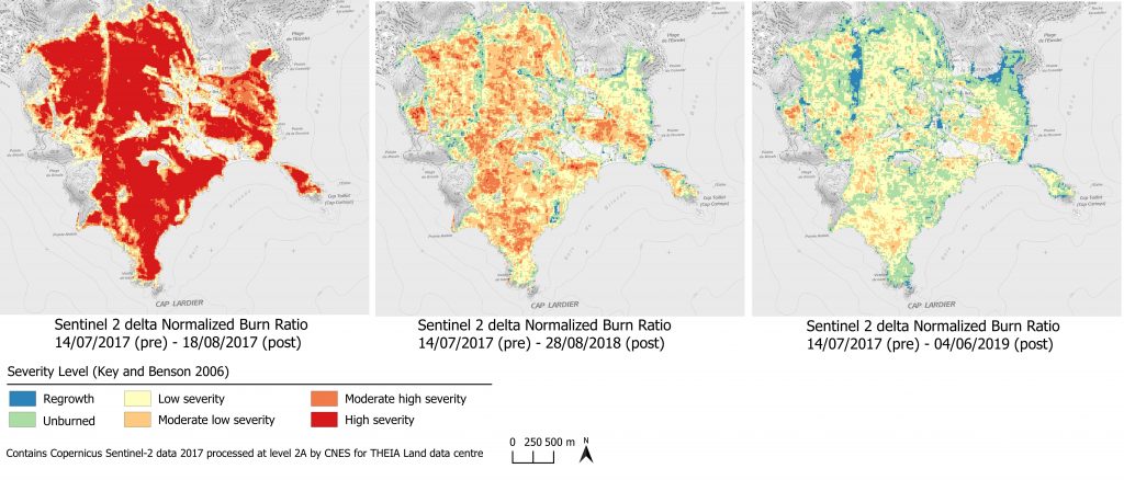
Map of vegetation evolution after a fire
This is a mapping of dNBR, in comparison with the year N of the fire: year N+1, year N+2… The result shows the 5 levels of severity as well as 1 level of regrowth.
Schedule:
- 2017: specification of treatment methods, first season of field calibration, and demonstration products using limited right-of-way imagery
- 2018: second season of field calibration, and development of an operational production line.
- 2019: production over the entire area subject to forest fires
- 2020: semi-automatic production of the three ESC products
- 2021: supply of on-demand cards during the season
Contact

Marielle Jappiot
INRAE | EMR
@M.Jappiot