Presentation
Theia Experts group in Forest Biomass and Changes in Forest Cover brings together teams from Cesbio that develop two products intended for ministries, FAO, REDD+, UNREDD and researchers in carbon and climate sciences :
1. Mapping of above-ground biomass (in tonnes/ha) of forests
2. Mapping of changes in forest cover following deforestation and forest degradation
Mapping of biomass at a scale of 25 m and an annual frequency for regional, national or global coverage. Mapping of changes in forest cover at a scale of 20m and a multi-year frequency, and almost real-time for hot spots.
The data used come from ALOS-PALSAR, Sentinel 1, ALOS 2 and Biomass (2021).
Schedule:
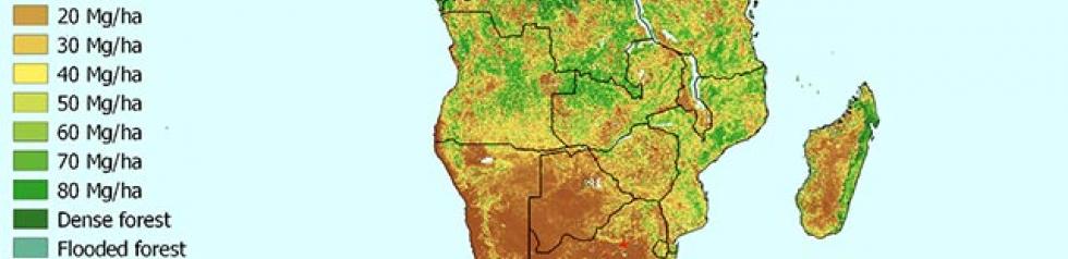
- 2017: biomass products (0-100 tonnes/ha) Africa
- 2018: biomass products (0-100 tonnes/ha) Africa + South America
- 2017-2018: Processing and production chain for the deforestation/ forest degradation monitoring product Figure 1 gives the example of biomass products over Africa.
- From 2021 onwards: production of biomass product (0-550 tonnes/ha)
Contact

Thuy Le Toan
Cesbio
@T.LeToan