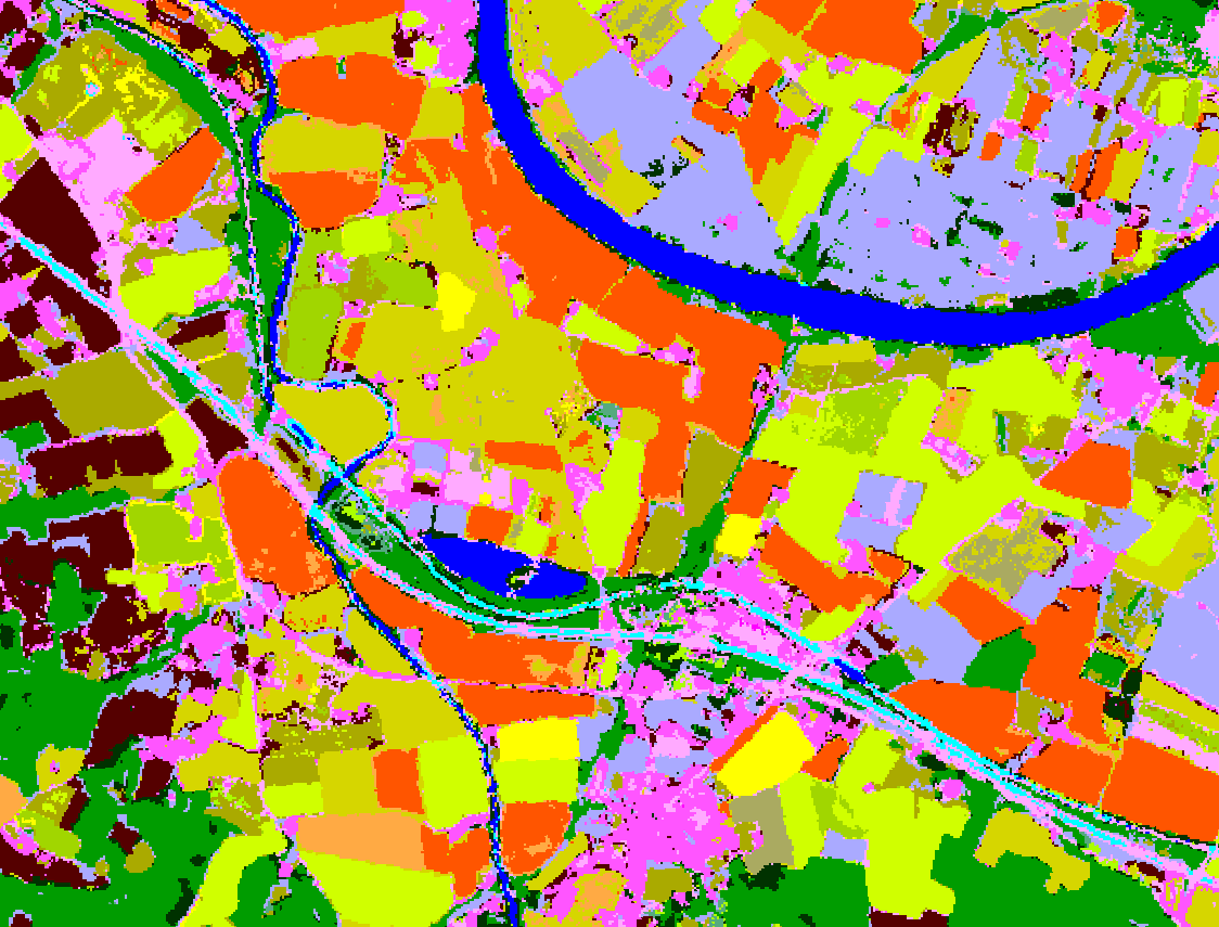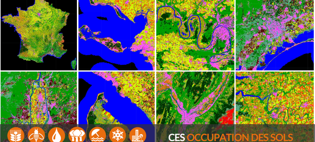
France Land Cover Map 2020 Focuses on Natural Classes
The new 10 m spatial resolution France Metropolitan Land Cover map has recently been released. This 2020 edition has been produced using the Sentinel L2A 2020 France data entirely produced by Theia. This year, a special effort was made to renew the sample set of natural classes (bare soil, grassland, moorland, forest) from updated official databases (IGN BD Topo and Corine Land Cover).
As a reminder, the CNES DNO/OT/PE service is responsible for producing, in collaboration with CESBIO, the Iota² processing chain (https://framagit.org/iota2-project/iota2) and for making these OSO maps available within the framework of CES Theia Land Cover.
Like all previous editions, the 2020 map is available on theia.cnes.fr freely. The RASTER format (whole France in tif format) is available to date. The VECTOR format (division by department in shapefile format) will be available by the end of the year (distribution in progress). They will also be accessible on the Theia map server: maps.theia-land.fr
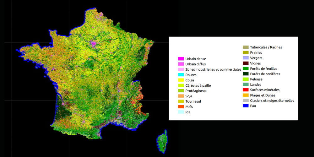
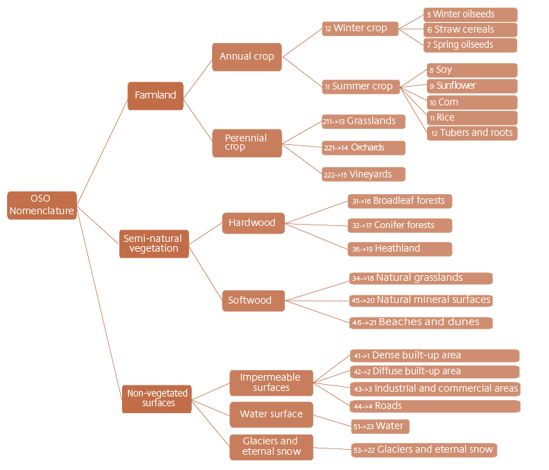
For the record, the 23 classes used are the following:
Contact

Vincent Thierion
INRAE | CESBIO
@V.Thierion
Contributions FR

Silvia Valero
CESBIO
Google Scholar
@S.Valero