
Presentation
Theia Irrigation Scientific Expertise Centre (SEC) brings together teams from Cesbio that develop high spatial resolution maps of irrigated / un-irrigated surfaces intended for regional chambers of agriculture, water supply agencies and watershed managers.
The product resulting from the Irrigated surfaces SEC is updated with an annual or biannual frequency. It has a decametric scale (between 10m and 20m) and covers all of France. Other sites may be taken into consideration on a case-by-case basis.
Different data are used: level 2A (or 3A) products from Sentinel-2, Sentinel-1 and Landsat-8 data.
Theia product presenting irrigated slots for a major part of Catalonia (Spain) in 2018. Produced using multitemporal Sentinel-1 data (september 2017 and december 2018). The typology irrigated/non-irrigated slots used only main sommer and winter crops.
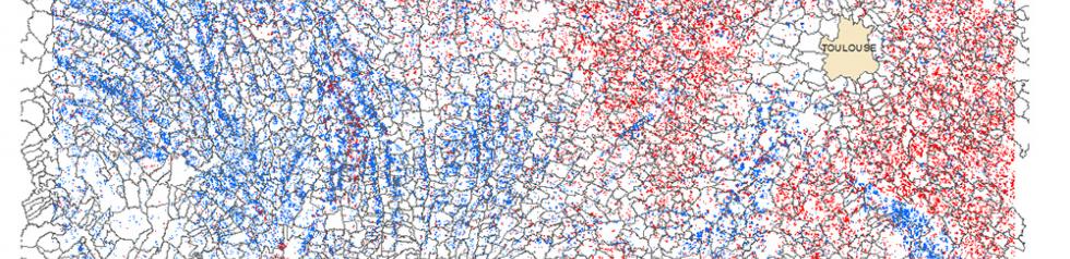
Theia product presenting the irrigated crops in 2015 in the South-West of France. Produced from 13 LANDSAT8 level 2A images.
Theia product presenting the irrigated crops aera in 2017 in Adour (France). Produced from Sentinel-2 data.
Theia product presenting the irrigated crops aera in 2017 in Tarn (France). Produced from Sentinel-2 data.


Schedule:
- 2015 – 2017: demonstration products, improvement of method, integration of Radar data
- 2018 – 2019: extension to other sites based on Sentinel-2 data
Contact

Valérie Demarez
CESBIO
ResearchGate
Contributions FR