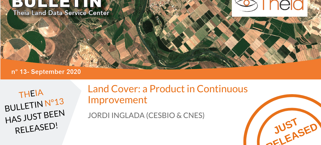
Land Cover: a Product in Continuous Improvement
The production of the land-cover map for metropolitan France has been carried out by the CNES MUSCATE operational team since the 2018 version. However, this does not mean that CESBIO, which had been running the production since the beginning of the Land Cover SEC, has stopped working for Theia. The same applies to the other partner laboratories of the Land Cover SEC. For CESBIO, we have continued to improve methods for large-scale land cover mapping and to integrate them into the iota2 processing chain.
The contributions of contextual classification
One of the important innovations is the contextual classification method developed by Dawa Derksen in the framework of his thesis. The details of the method were published in the Remote Sensing journal, showing that the method does as well as approaches using Deep Learning, but at a much lower cost in terms of computation (and therefore energy).
The particularity of the method is that it makes it possible to take into account the neighbourhood of a pixel in the classification procedure. In particular, this makes it possible to reduce errors in the land cover classes that are characterized by spatial heterogeneity, such as discontinuous urban fabric, orchards, etc.
Although the method is integrated into the production chain, we did not use it for the 2019 version published in March 2020. Indeed, the Land Cover SEC and Theia are committed to ensure product continuity by introducing modifications only if they improve the quality of the product and remain compatible with previous maps. Therefore we have published a prototype product in order to collect the opinions of users: a 2018 map for one third of the south of France (about 30 Sentinel-2 tiles).
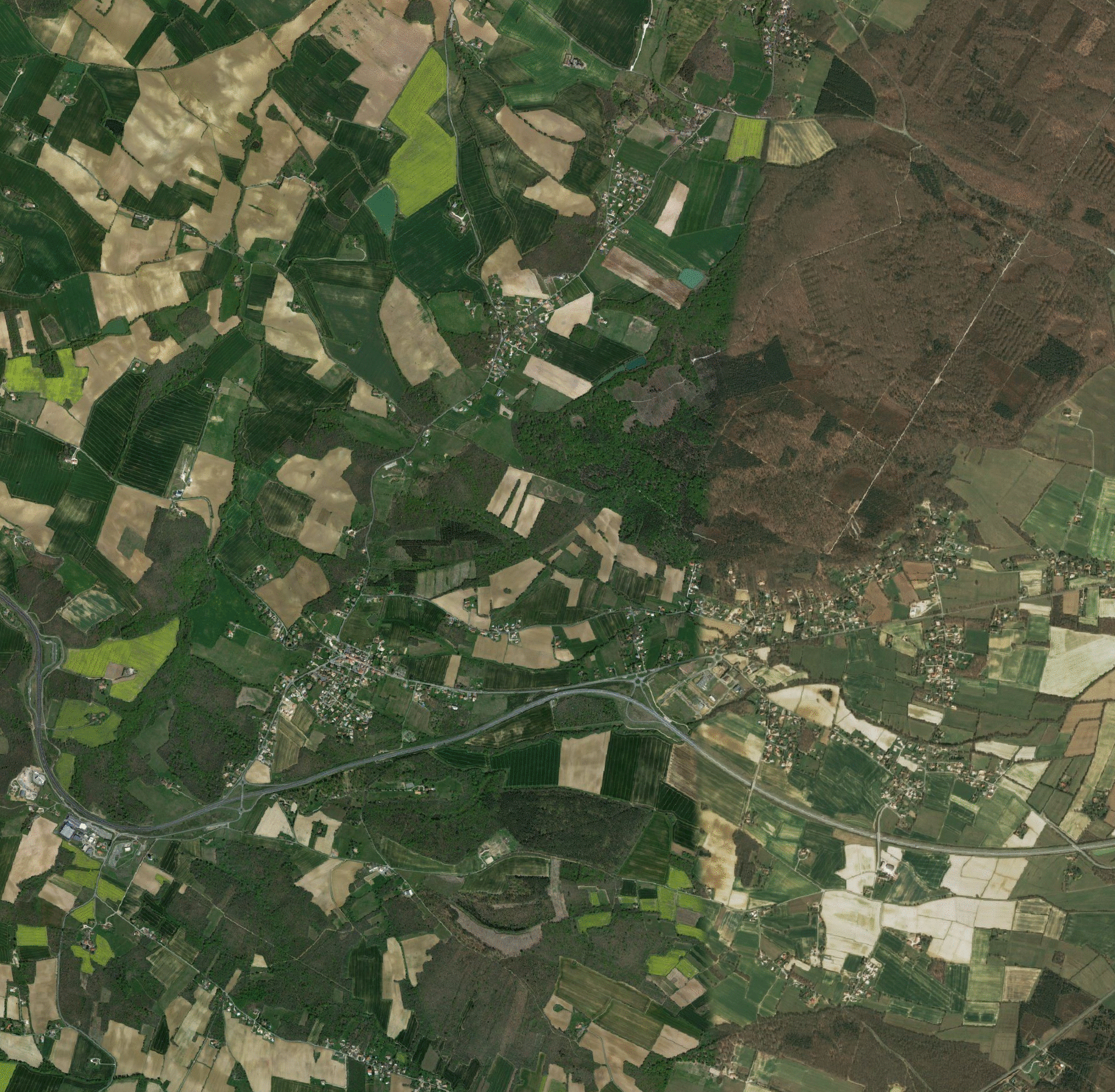
Figures 1, 2 and 3 show respectively an aerial view, the map produced with the classical method and the map produced with the contextual method, over a small area. Table 1 below gives the validation statistics for the complete area of the 30 tiles. The contextual version contains less noise while keeping a precise definition of the shape of the objects. There is also a gain in terms of precision for all classes. However, these statistics must be interpreted with care, as they do not allow for local errors that could be important from a cartographic point of view. For this reason, the opinion of Theia Land Cover product users is very important.
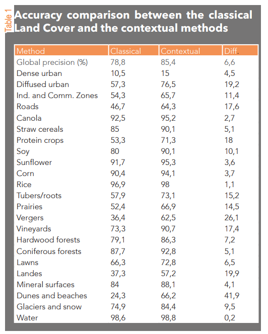
The first feedback is quite favourable, but it shows that there are still some adjustments to be made before going operational. We are always open to comments and suggestions.
Iota-2
We have also worked hard to improve the iota2 processing chain. Indeed, this free software developed at CESBIO is both a research platform and a production chain. As such, it is used by research laboratories and industry for mapping activities quite different from Land Cover.
We have therefore made iota2 evolve to make it easy for other Land Cover SEC laboratories to contribute, but also to make the chain useful to other SECs where the objective is cartographic production (Variables for Biodiversity SEC, Irrigation SEC, etc.).
For this work, the TOSCA programme of the CNES funds the PARCELLE project, which federates the laboratories carrying these SECs. The objective is to identify the specific needs of these SECs and to develop iota2 accordingly.
The processing chain has been made easier to install and use, its documentation has been enriched and the contribution of code by users has been facilitated. In parallel with the PARCELLE project, other software optimization work was carried out. All these evolutions are not directly visible, but they make it possible to propose a toolbox to build production chains for Theia’s SECs.

Jordi Inglada
Cesbio
ResearchGate
@J.Inglada
Contributions