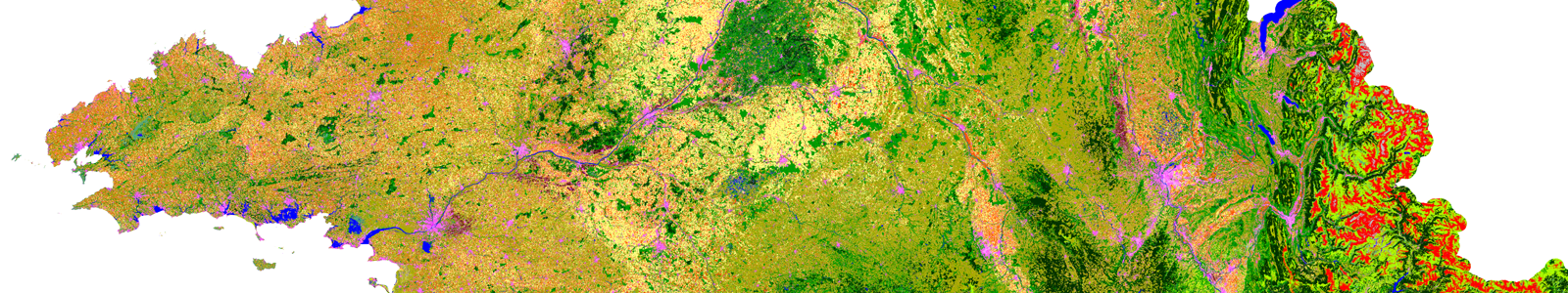
Land Cover on Reunion Island
A Specific Product to Map Land Cover on Reunion Island
In Reunion Island, within the framework of the GABiR project (Agricultural Management of Biomasses on the scale of Reunion Island), we needed exhaustive and up-to-date information on agricultural land use at the level of the whole territory. In this context, we decided to test the prototype Moringa chain on Reunion Island to assess whether it could meet the needs for information on land use. This tool, developed within the framework of Theia Land Cover Scientific Expertise Center (SEC), uses functions from the Orfeo Tool Box (OTB), controlled by python scripts. To function, a very high spatial resolution image (Spot6/7 or Pleiades) and a DTM, a terrain database and a time series (Sentinel-2 and Landsat-8) constitute the minimum requirement.
Homogeneous objects are extracted from the very high spatial resolution image using a segmentation algorithm. This image is also used to compute textures. Each object is then classified by a supervised classification algorithm (Random Forest) using as variables the information from the time series, textures and elevation and slope information from the DTM.
Meeting users’ needs
The reference database was built using existing products (DAAF land use database, Registre Parcellaire Graphique and BD Topo distributed by the IGN) but also in collaboration with partners and users of the final maps: Syndicat du Sucre de la Réunion, DEAL, ONF, researchers from the Université de la Réunion and CIRAD (UMRs SELMET, PVBMT, HORTSYS and UPR AIDA). This database has been expanded over the course of these collaborations in order to be as exhaustive as possible and to produce maps that meet the needs of a wide range of users (> Read the focus on uses by Pascal Degenne in the framework of the GABiR project, and by Béatrice Moppert on savannas).
Despite the difficulties related to the size of the data, we tested the feasibility of producing land-use maps from a segmentation based on Pleiades images acquired by the Cnes in the framework of the Kalideos project
Go further

Three Applications Within the GABiR Project
- Evaluation of the areas concerned by the regulatory constraints on the spreading of livestock manure on an island scale. The classes representing cultivated plots likely to receive organic fertilization were extracted from the map. They were used as a basis for calculating the areas affected by the various constraints such as distances to watercourses, the risk of runoff on slopes, and the distance to buildings or to the drinking water catchment point. This makes it possible to construct indicators relating to the areas that can be spread on the scale of the island, on which it is possible to have multi-year monitoring thanks to the reproducible nature of the method used for land use.
- Influence of urban dynamics on organic fertilization at the scale of a municipality. The land cover map was used to locate the plots not referenced in the institutional or administrative databases and likely to be concerned by organic fertilization. Fieldwork was then carried out to validate or not the plots thus identified. Projections of future constructions (in particular provided for in the Local Urban Planning Plan) were mapped and were used to estimate and map precisely the risks of loss of spreadable surfaces in the commune. (u These two applications are illustrated by the maps on the opposite page).
- Support for the management of fodder resources, in time and space, for pastoralism. A census of herds and flocks has been carried out to estimate and map fodder requirements according to the seasons. Another work mobilized land use mapping to estimate fodder resources. Here too, the map was used to locate plots that were not available in the databases available to the project. Then, by expert appraisal and photo-interpretation, doubts were removed from the identified plots. Finally, these plots were mobilized for simulations of fodder production, transfer, storage and consumption. <

(a) parcel provided to the software,
(b) 35 m strips on either side of watercourses in orange and estimated runoff risk by the software in yellow,
(c) example of distance constraint at 50m from the built-up areas,
(d) cutting out the non-applicable areas on the parcel provided and assembling them into a map. The colors indicate constraints related to different types of organic matter.
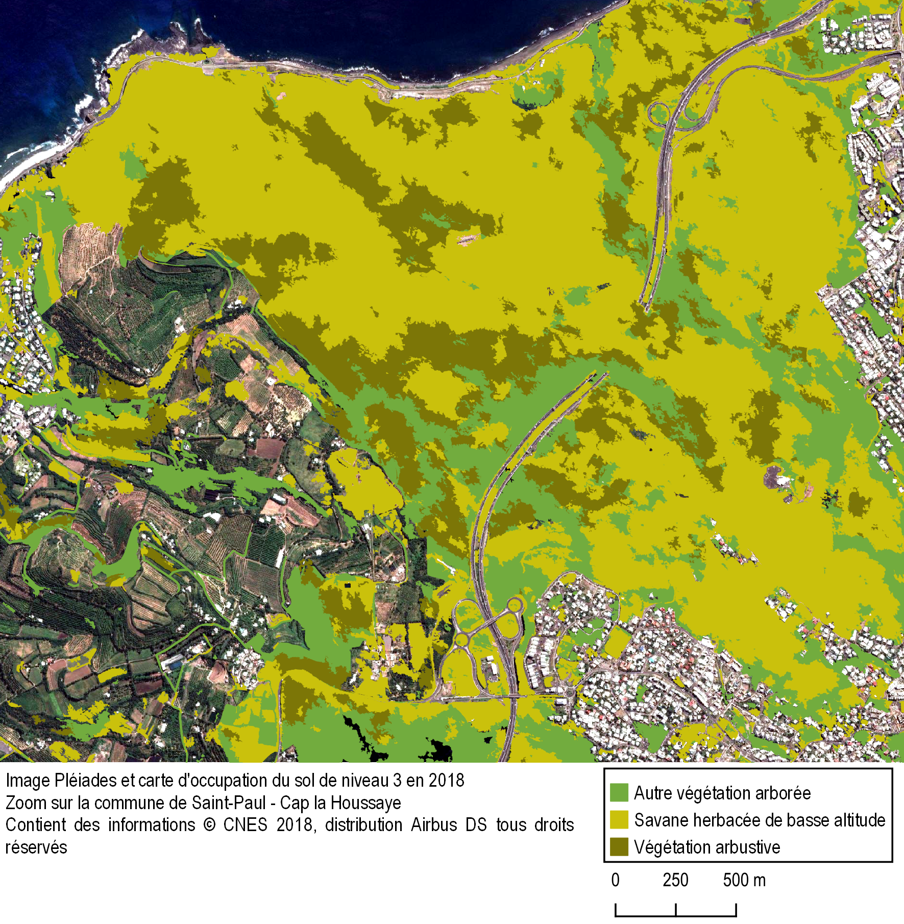
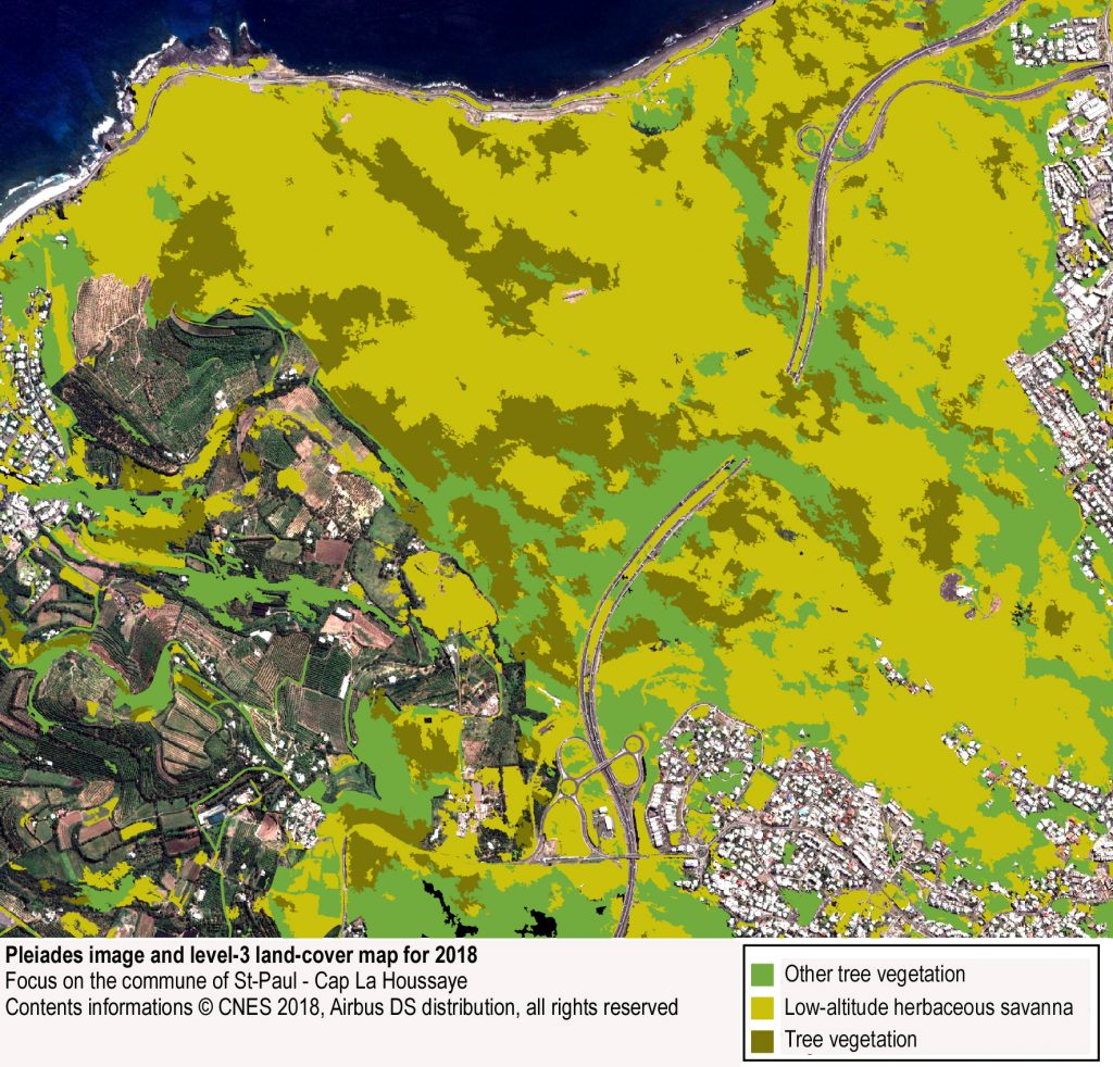
This mapping uses the 2017 Reunion land cover maps.

Pascal Degenne
Cirad |Tetis
Mapping the savannas of the Leeward Coast
The research program «Les savanes de la côte sous le vent à La Réunion» – Savannas of the Reunion Leeward Coast – is conducting an interdisciplinary and experimental approach to the knowledge and management of coastal environments. It is based on past and current work carried out for the Conservatoire du littoral in Reunion Island and proposes a historical approach to environments and landscapes in order to establish alternative practices in terms of environmental conservation and management.
A tool adapted to the study of the landscape
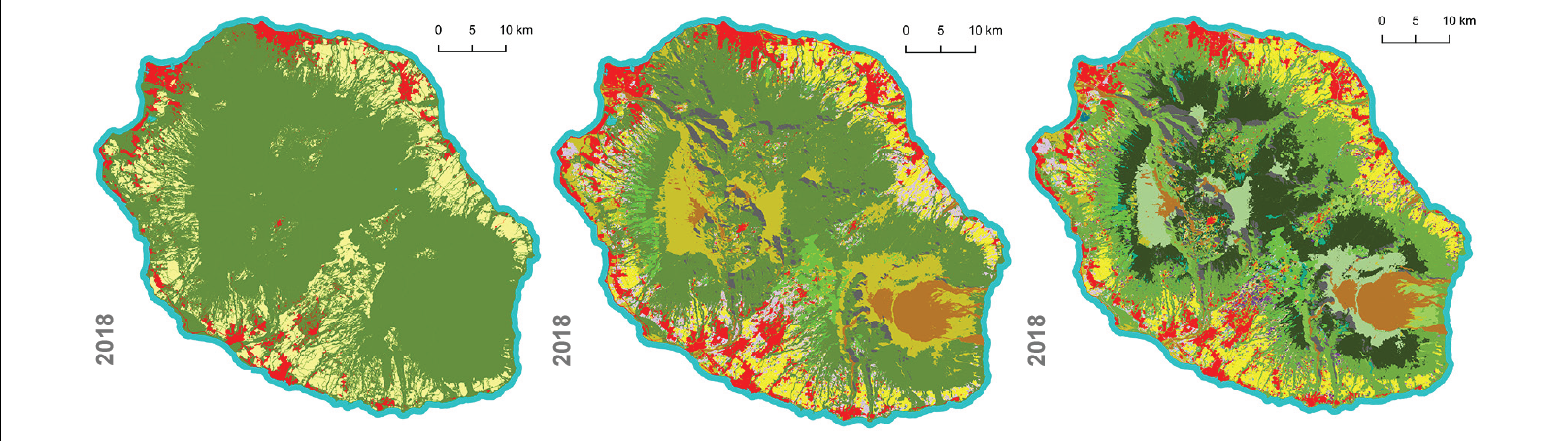
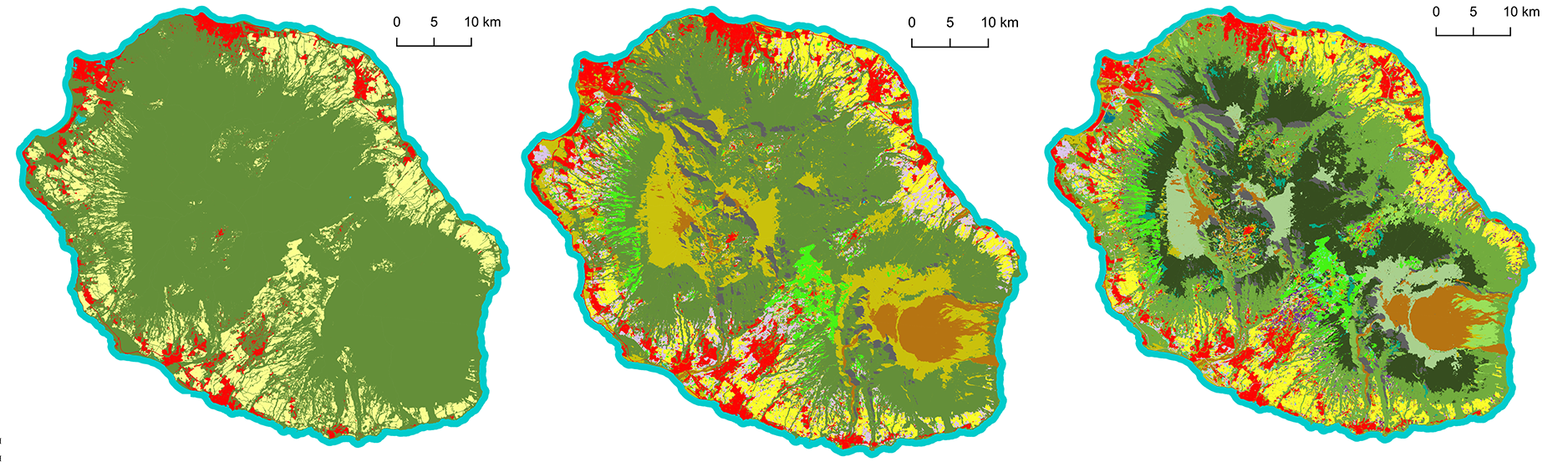
At the interface between the various components of this project and involving researchers from various disciplines, a mapping component aims to clarify the land use dynamics in the lower western zone and, more specifically, to reveal the expansion processes of shrub species in herbaceous environments. The land-cover map produced by Stéphane Dupuy is the best existing working base to date. Since 2018, the map has included new learning classes that make it possible to distinguish three savanna formations: herbaceous, shrubby and woody.
Within the framework of the Western Savannah project, it is thus possible to distinguish, on the one hand, savanna areas in relation to other modes of land use (built, cultural, other natural areas) and, on the other hand, three categories of landscape facies within the savanna areas themselves. These typologies will have to be specified through field work envisaged within the framework of the research program on the Reunion savannas.
Béatrice Moppert
Université de la Réunion
General public exhibition & plant typology
- Carrying out a cartography entitled “Dry plant formations of the leeward coast of Reunion Island (2018)” as part of the Savanna. La liberté sous le vent, organized by the research team and the commune of Saint-Paulet and inaugurated in September 2019
- Work on the plant typology of the savannas based on the ODS map of 2018 (field + photo-interpretation)
Read the New Theia Bulletin
>>> Read on-line on Calaméo