Landsat 8 level 2A processing just started
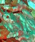
At the beginning of the week, the Musacte prototype processing center of Theia started processing the LANDSAT 8 data available in France. The processing started with the 2013 data, which will be transformed into Level 2A products. As for SPOT4 (Take5), the level 2A products are expressed in surface reflectance after atmospheric correction, and are provided with a cloud mask, a cloud shadows mask, a water and snow mask.but in the case of LANDSAT 8, the products are split into tiles on a 100*100 km² grid, and each tile is 110*110 km² to allow an overlap of 10 km between tiles.
Landsat 8 data should progressively appear on THEIA’s catalog in less than a month (but this is a risky assertion, as it is the first time we do this production and surprises may arise, although we spent a lot of time in validation, both at CESBIO and CNES).
More details are available here.