Data access
Presentation
Theia Snow product is generated from Sentinel-2 (20m resolution, every 5 days or less) and Landsat-8 images over selected areas of the globe (see map below). For precise and justified research needs, it is nevertheless possible to request a particular production, subject to production capacity.
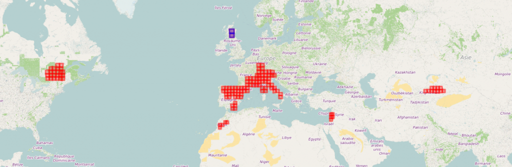
An interactive map gives more details
Two Data Levels
Theia Snow product is available with two data levels :
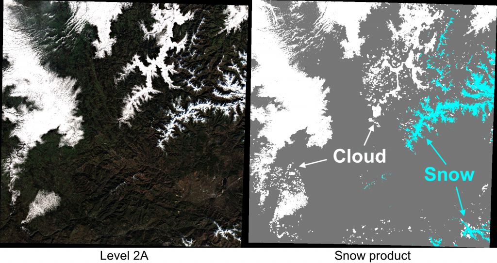
>>> level 2 offers monotemporal data, i.e. from ortho-rectified Sentinel-2 mono-date images, expressed in surface reflectance and accompanied by a cloud mask.
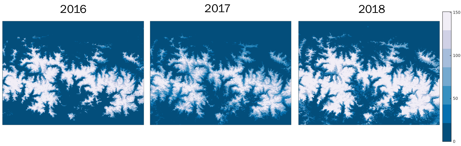
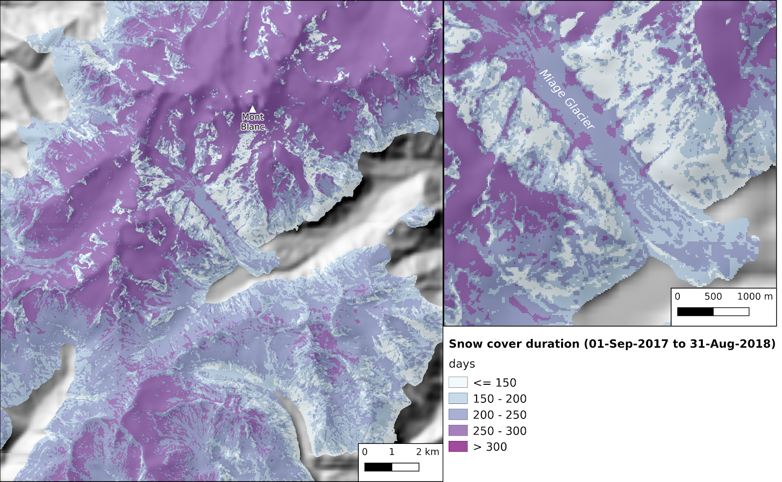
>>> level 3 offers annual syntheses of snow cover duration per pixel between September 1 and August 31
Livestreamed Snow Cover Data
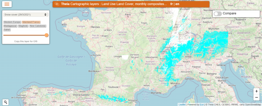
The maps.theia-land.fr geographic layer server offers the possibility to visualise online or in your GIS software the current state of the snow cover for metropolitan France, broadcast in WMTS and calculated from the last 20 days.
Further resource on Theia Snow product
An article on Cesbio blog explaining the different Sentinel-2 data treatments involved.
The algorithm and the scientific evaluation of Theia Snow products are detailed in this article : Theia Snow collection: high-resolution operational snow cover maps from Sentinel-2 and Landsat-8 data, Earth Syst. Sci. Data, 11, 493–514, 2019. Gascoin, S., Grizonnet, M., Bouchet, M., Salgues, G., and Hagolle, O.
The documentation is available here: https://doi.org/10.5281/zenodo.1414452
Warning
Both products present a high quality since users should be warned of the possible following defects:
- Some cold, low elevation, clouds can be wrongly classified as “snow”. These clouds have a spectral signature similar to the one of the snow cover.
- Shaded, steep, snow covered slopes can be wrongly classified as “no-snow”, especially in winter when the sun elevation angle is low at the time of the image acquisition. These slopes have a low signal-to-noise ratio and should be considered as no-data.
- The product is not reliable in areas of dense forest because the canopy obstructs the surface.
Contact

Simon Gascoin
CNRS | CESBIO
@S.Gascoin
Contributions

Guillaume Eynard-Bontemps
Cnes
@G.Eynard-Bontemps
Level
The product is distributed by Theia as a raster file (8 bits GeoTIFF) of 20 m resolution and a vector file (Shapefile polygons)
- Raster files are named SENTINEL2A*SNW_R2.tif. Pixels are coded as follows:
- 0: No-snow
- 100: Snow
- 205: Cloud including cloud shadow
- 254: No data
- Vector files are named SENTINEL2A*SNW_R2.{shp,shx,prj,dbf} and coded with the DN field
- 0: No-snow
- 100: Snow
- 205: Cloud including cloud shadow
- 254: No data
Style files to display the snow product in QGIS (raster and vector) are available.
This video tutorial shows how to download a product from your web browser and display it in QGIS. You can also use this script in python to download the products from your terminal.
Licence
The Sentinel-2 level 2A or 3A data distributed by THEIA are distributed under the ETALAB V2.0 open license, details of which are available here: Français | English.
The processor code and its documentation are available under a free software licence: