Data access
Presentation
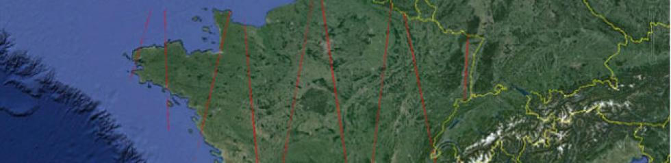
LiDAR data were acquired by the Geoscience Laser Altimeter System (GLAS) on board the Ice, Cloud, and Land Elevation Satellite (ICESat) between 2003 and 2009 :
- France
- Afrique : Cameroon, Congo, Ivory Coast, Gabon, Ghana, Equatorial Guinea, Liberia, Madagascar, Republic of Congo, Africa Central Republic, Surinam
- South America : Guyana, French Guyana, Argentina, Chili
- Asia : Iran
GLAS 1064nm waveforms correspond to backscatter energy as a function of time. They are digitized in 544 or 1000 bins with a bin size of 1ns for land (15 cm vertical resolution), corresponding to 81.6 m and 150m height ranges, respectively. The GLAS laser footprints have a near circular shape of about 70 m in diameter and a footprint spacing of about 170 m along the track.
In total, 1082184 recorded signals (waveforms) were acquired over France by the Geoscience Laser Altimeter System (GLAS). Of the 15 GLA data products, only products GLA01 and GLA14 in release 33 were used in this research. For each GLAS footprint, these products provided a raw waveform, an acquisition date and time, the precise geolocation of the footprint center, waveform parameters derived from the Gaussian decomposition, the estimated noise level, i.e. the mean and standard deviation of background noise values in the waveform, etc. Each received waveform was decomposed into a maximum of six Gaussian functions.
Acknowledgments
We wish to thank the National Snow and Ice Data Center (NSDIC) for the distribution of the GLAS/ICESat data
Satellite
Name : GLAS ICESat
Imaging mode : Lidar
Spectral bands : Near infrared
Footprint : ~ 60 m
Observation capability : Tâches au sol espacées de 170 m
Coverage :
- Areas : France, South America, Asia
- Period : 2003 – 2009
For more information see nsidc.org.
Format
Folder « Formes_onde_jpeg »: contains for the 16 GLAS/ICESat missions (L1 to L3) the waveforms in JPEG format.
Folder « Formes_onde_ascii »: contains for the 16 GLAS/ICESat missions the waveforms in ASCII format (raw waveform in Volts with a sampling frequency of 1ns, the smoothed waveform, and the sum of Gaussians resulting from the waveform decomposition « up to 6 Gaussians »)
Folder « Localisation »: contains for the 16 GLAS/ICESat missions a vector file in both shapefile kml formats. The vector file contains the location of each GLAS footprint, the acquisition date, and the elevation of the centroid.
Variables :
- ID: the waveform identifier
- CElev (m): centroid elevation. The ICESat ellipsoidal heights (TOPEX/Poseidon ellipsoid) were transformed to the WGS84 ellipsoid by subtracting 70 cm.
- Date: acquisition date (dd/mm/yyyy hh:mm:ss AM or PM)
- Raw waveform: the raw GLAS waveform
- Smoothed waveform: the smoothed GLAS waveform
- Sum of Gaussians: the sum of the Gaussians resulting from the decomposition of the waveform.
- Gi (i from 1 to 6 maximum): the position of the Gi Gaussian in ns
- GiA(V): amplitude of the Gi Gaussian in Volts
- G1Std-dev (ns): standard deviation of the Gaussian in ns
- Signal start and Signal end (ns): signal start and signal end for a threshold of µb + 3.5σb and µb + 4.5 σb (µb and σb are the mean and the standard deviation of the background noise).
LICENSE
http://nsidc.org/data/icesat/disclaimer.html
LINKS
NSIDC Attributes for ICESat Laser Operations Periods. http://nsidc.org/data/icesat/laser_op_periods.html (January 2012). This project was funded by the CNES (French Space Agency)