Maps of soil particle size fractions (clay, silt, sand) and coarse element content for metropolitan France

Maps of soil particle size fractions (clay, silt, sand) and coarse element content for metropolitan France

Theia Digital Soil Mapping CES produces a series of maps of soil particle size fractions (clay, silt, sand) and coarse element content for metropolitan France.
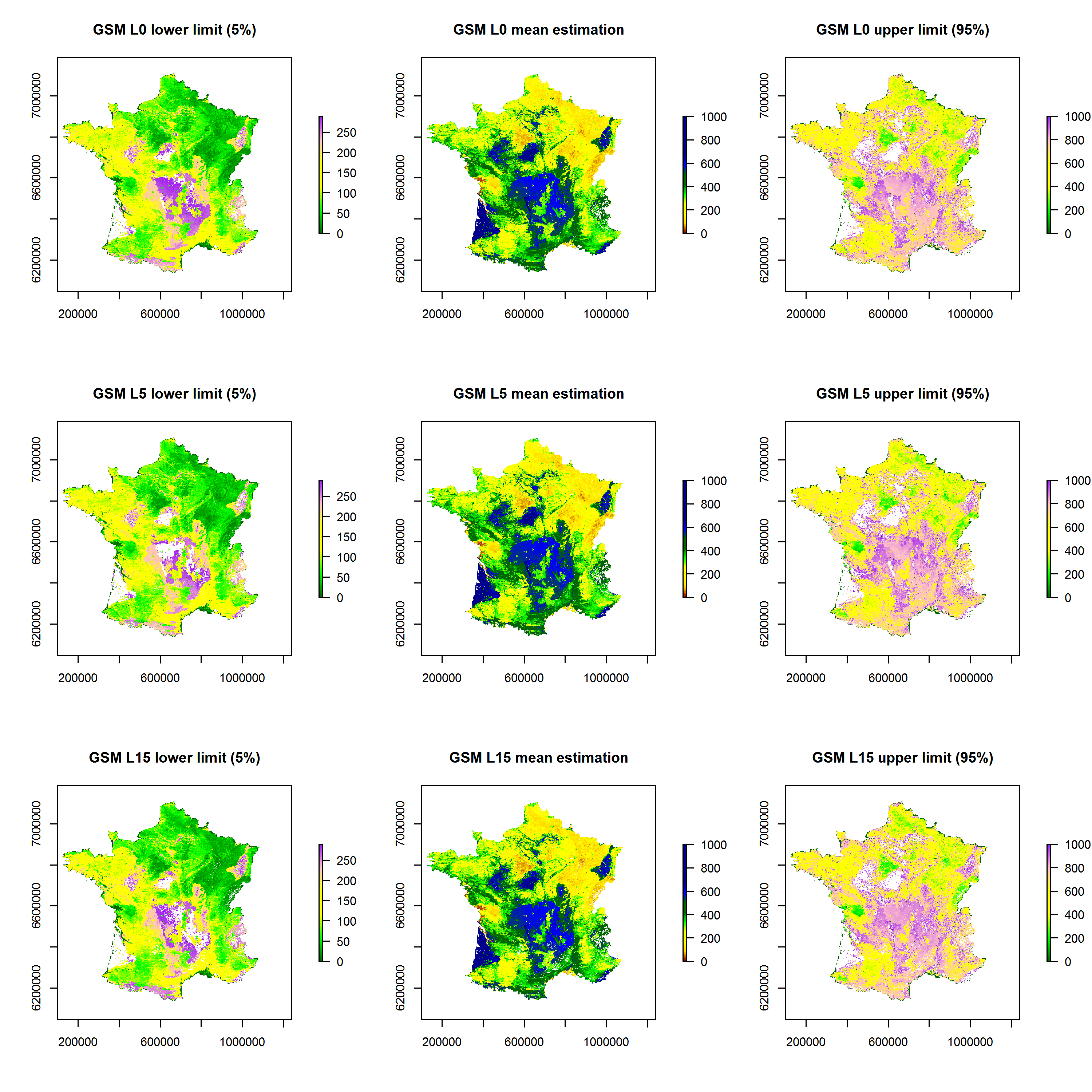
Sand content maps for the 0-5 cm, 5-15 cm and 15-30 cm soil layers according to the GlobalSoilMap specifications for metropolitan France
Sand content maps for the 0-5 cm, 5-15 cm and 15-30 cm soil layers according to the GlobalSoilMap specifications for metropolitan France (source : https://entrepot.recherche.data.gouv.fr/dataset.xhtml?persistentId=doi:10.57745/N4E4NE)
Data at 90 m intervals are available on: https://entrepot.recherche.data.gouv.fr/dataset.xhtml?persistentId=doi:10.57745/N4E4NE

Search