Access
Description
Theia SCO THERMOCITY project consists of studying urban heat islands and heat loss from urban thermographs based on satellite images [1]. The first stage of the project consisted of generating a collection of thermal data on 5 major French cities: Aix-Marseille, Montpellier, Paris, Strasbourg and Toulouse. The cities of Montpellier, Strasbourg and Toulouse are involved in the project.
For each city, about ten images from the ASTER and ECOSTRESS missions were selected to cover the different possible configurations: summer/winter, day/night [2,3].
Data and methods
The source data came from the American NASA missions ASTER and ECOSTRESS and were cut out in a region of interest of 100 km around the 5 studied metropolises.
The processing applied to the data is described in the reports [4,5] and can be summarised as follows:
- Geometric registration on Sentinel-2 to ensure good absolute geolocation, good multi-temporal superimposability and the possibility of cross-referencing multi-mission and exogenous data.
- Atmospheric correction using Météo-France weather profiles from the latest reanalyses
- Emissivity/temperature separation with a TES algorithm specially trained for the urban environment
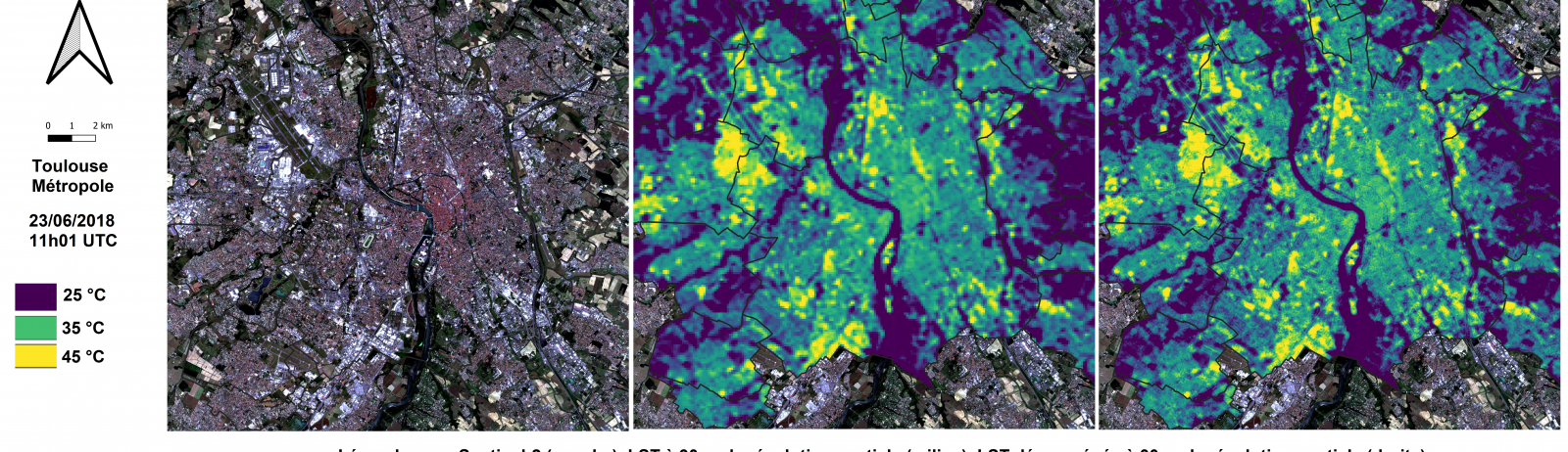
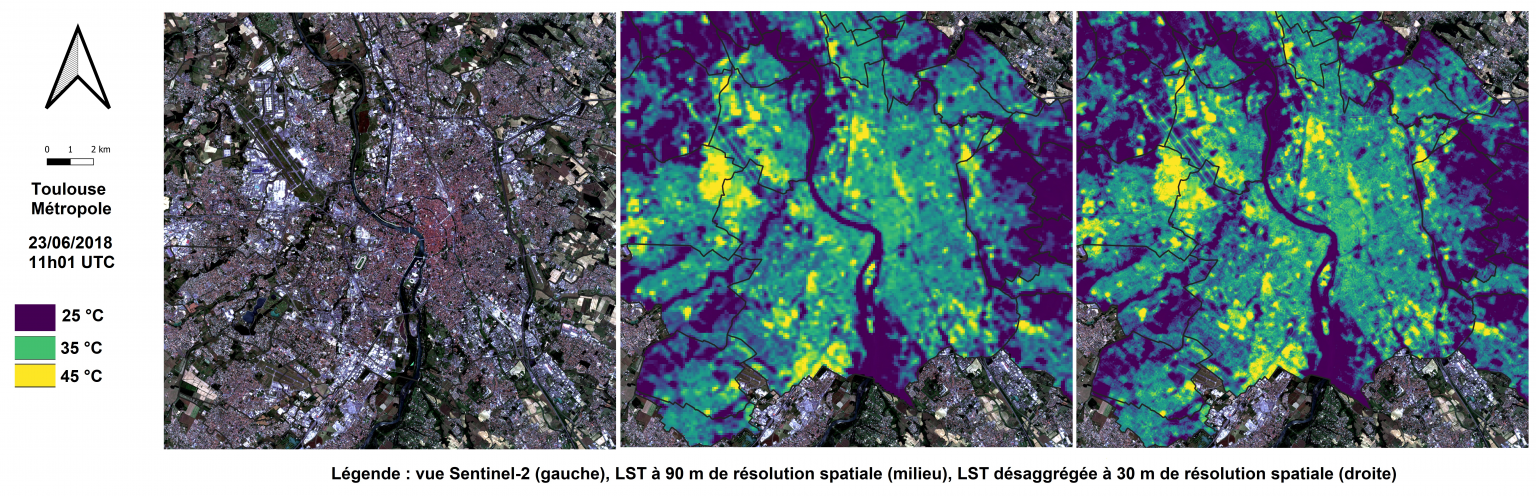
- Super-resolution: improvement of the spatial resolution of thermal data by a statistical approach for ASTER
The thermal products obtained in surface temperature are matched with a quality mask in order to be able to discard certain values according to the analyses. Indeed, the 3D structure and metallic materials are potential sources of error. The improvement of the temperature-emissivity separation and the spatial resolution already allows the thermal products to be used for in-depth studies based on the needs of the metropolises – this is the second phase of the SCO THERMOCITY project, which ends in 2022.
Contact

Laure Roupioz
Ingénieure de recherche à l’Onera
@L.Roupioz

Aurélie Michel
Onera | DOTA
ResearchGate

Vincent Lonjou
CNES
@V.Lonjou
References
[1] THERMOCITY project description by the SCO: www.spaceclimateobservatory.org/fr/thermocity-toulouse
[2] ASTER: https://asterweb.jpl.nasa.gov/
[3] ECOSTRESS: https://ecostress.jpl.nasa.gov/
[4] CNES Technical Note technique CNES on geometrical corrections: www.theia-land.fr/wp-content/uploads/2021/12/CORRECTION_GEO_THERMOCITY_TN_V1.pdf
[5] ONERA Technical Note on radiometric corrections and super-resolution: www.theia-land.fr/wp-content/uploads/2022/01/RT_THERMOCITY_pourCES.pdf