Data access
A Python Script to download entire collections
A Python script to download entire collections
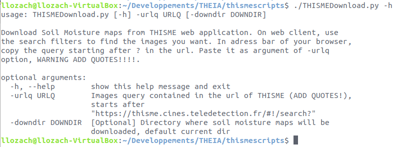
To facilitate entire collection download, an automatic THISMEDownload.py script has been developed by Loïc Lozac’h (INRAE engineer). The script is usable only on a Linux system because it contains dependencies (curl, wget) only available on this system. It allows batch downloading of the data present on the THISME web application.
Directions
- On the THISME web application, launch a search via the client interface.
- The query corresponding to this search is displayed in the address bar of your browser.
- Copy this address from the question mark (?)
- Use this query as an argument to the -urlq option in the THISMEDownload.py script
- Don’t forget to put the query in quotes.
For example, to download the collection corresponding to Central Italy, write :
THISMEDownload.py -urlq "q=%23Central-Italy&collection=SoilMoisture"
Data description
Registre parcellaire graphique (RPG)
National Center for Remote Sensing Lebanon
IBG-3 | Frank Hermann
Corine Land Cover | Copernicus
LMI TREMA Maroc | Vincent Simmoneaux
SIGPAC Espagne
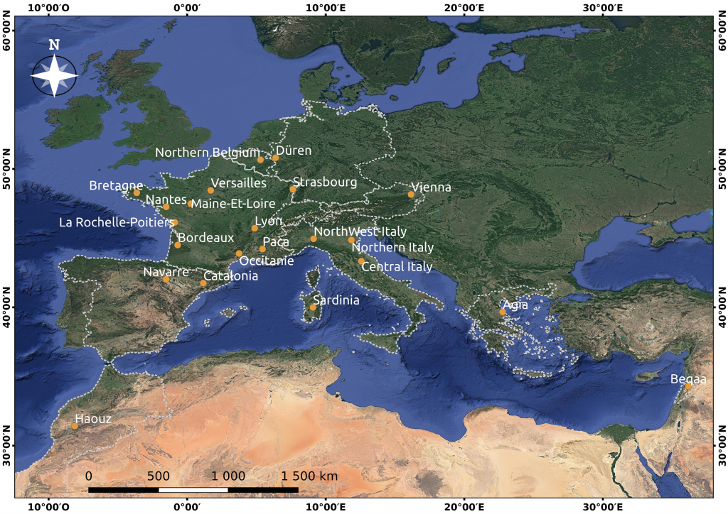
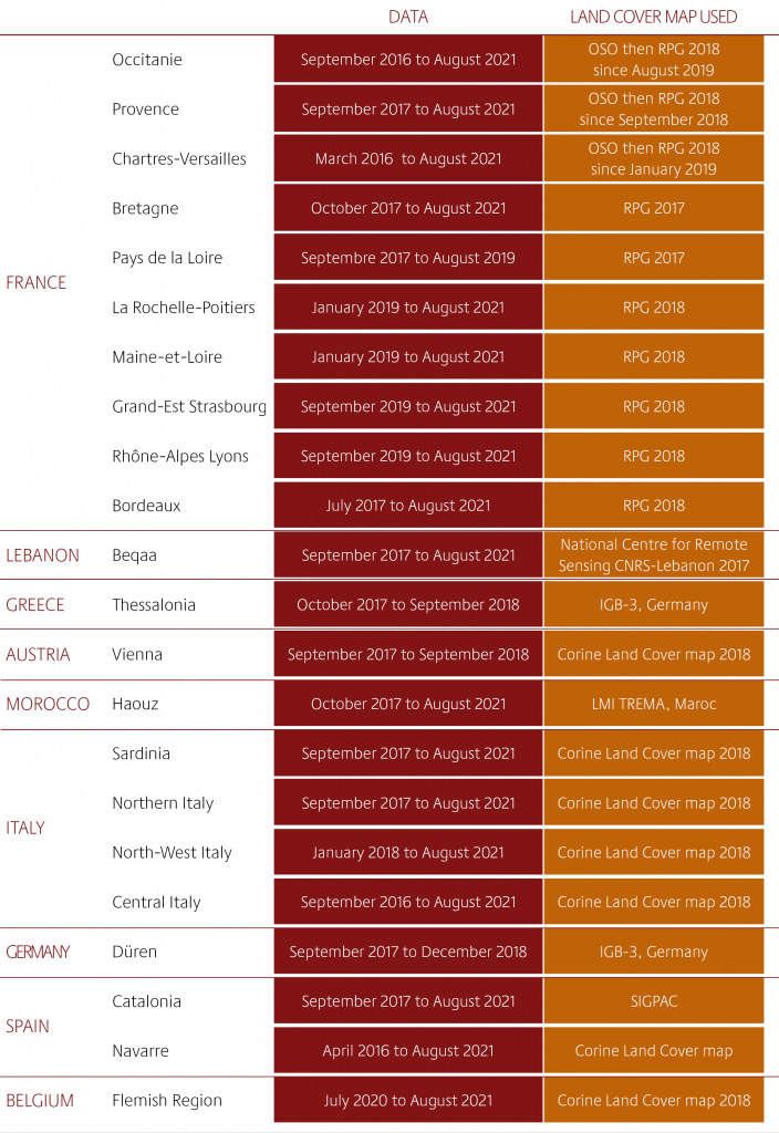
Available data in December 2021
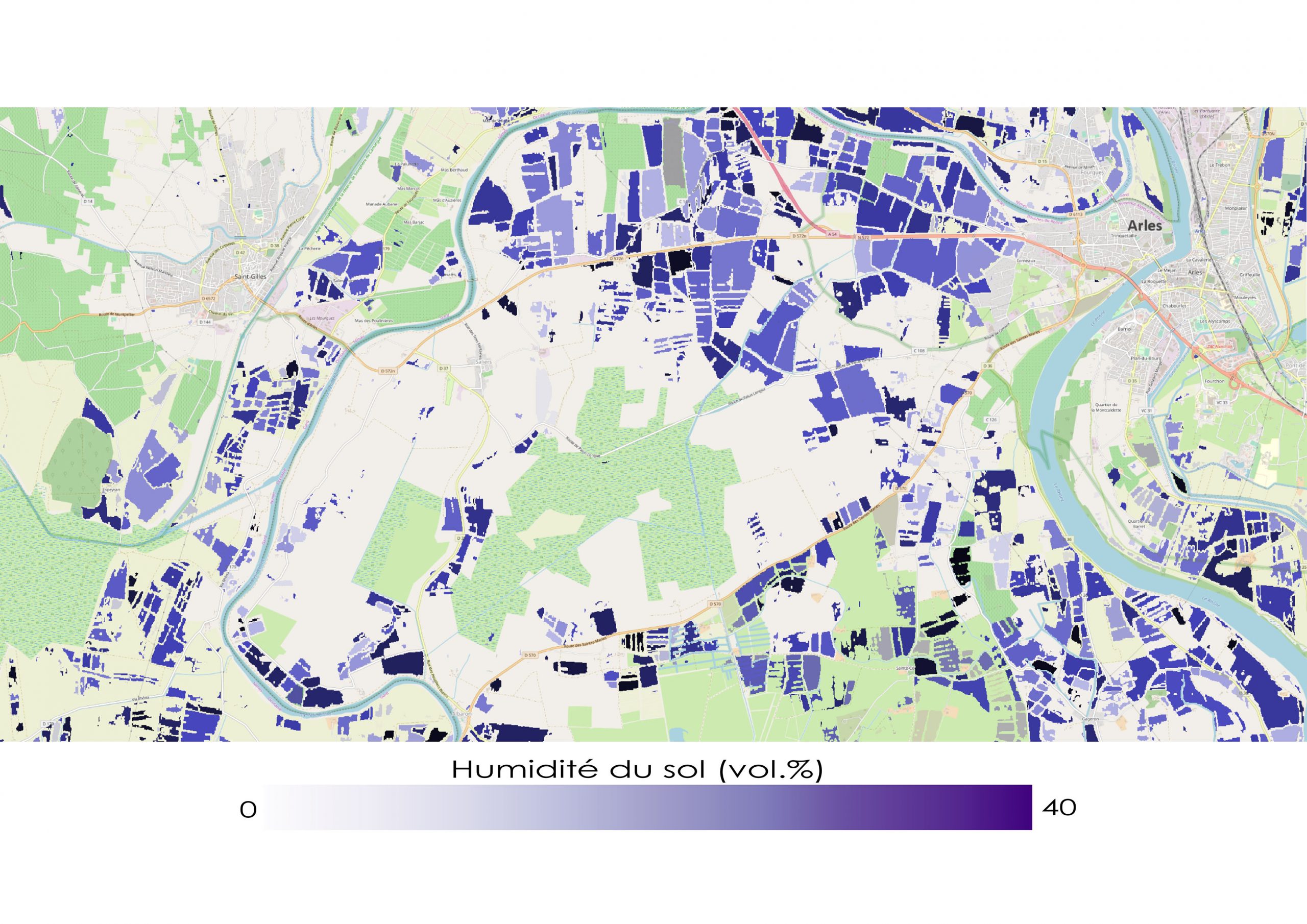
The VHSR Soil Moisture product
The “Soil moisture with very high spatial resolution” SEC offers soil moisture maps with frequent repetition (a map every six days) at the sub-parcel scale on several sites in France, in Europe and around the Mediterranean basin.
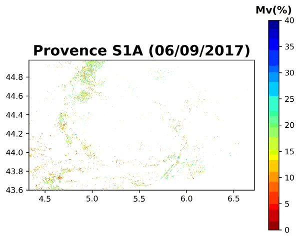
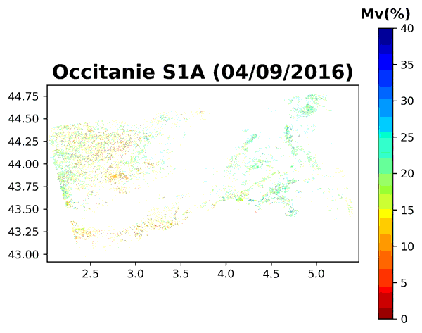
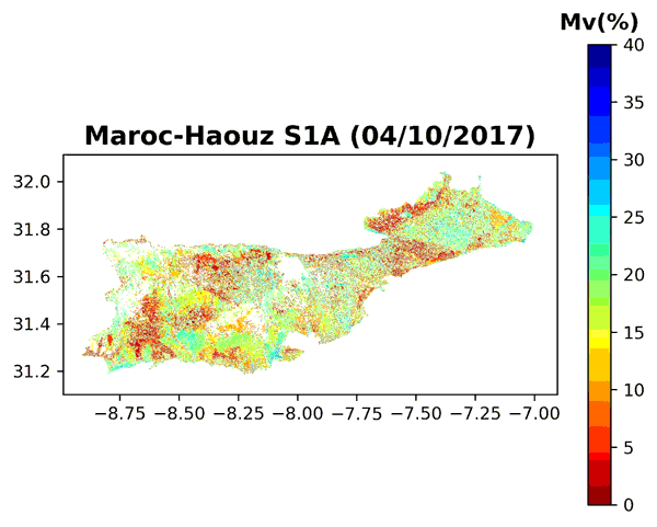
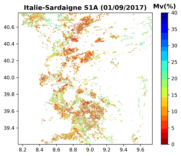
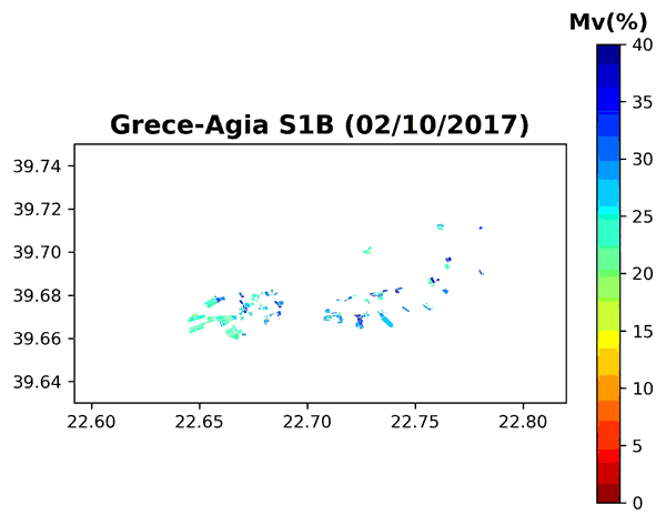
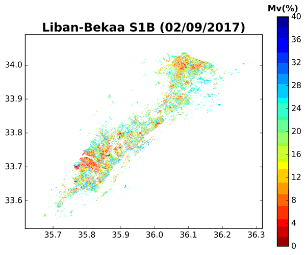
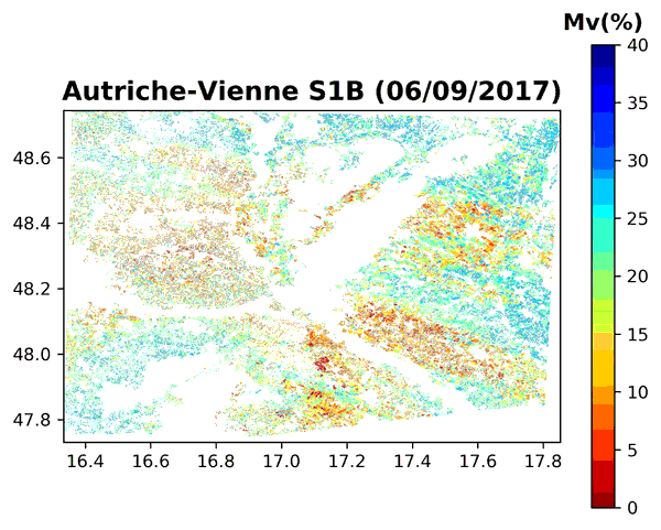
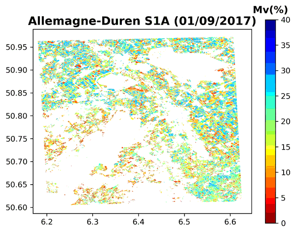
Some examples of Soil Moisture Data series
Algorithms were developed and moisture maps produced with the support of IRSTEA (UMR TETIS) and CNES (TOSCA Project). This work was carried out in close collaboration with Mehrez Zribi at CESBIO.
The data used come from the Sentinel-1 radar and Sentinel-2 optical Copernicus image series. The radar signal inversion algorithm uses neural networks. It is applied to agricultural parcels (with or without vegetation) extracted from the 2016 and 2017 land cover maps produced by the Theia Land Cover SEC (Jordi Inglada et al., CESBIO).
Sentinel-2 images were used to calculate the NDVI (normalized difference vegetation index). This index is a necessary input for the inversion algorithm, both in order to divide the agricultural areas resulting from the land cover map and to simulate the contribution of vegetation to the total radar signal received by the satellite. Segmentation allows homogeneous polygons inside agricultural parcels to be extracted, and, as a result, allows objects to be offered that are finer than the outline of the parcels.
Thanks to a large field campaign close to the city of Montpellier (almost 500 in situ measurements), the precision for the soil moisture estimate reaches 6 vol.%.
Contact

Nicolas Baghdadi
INRAE | Tetis
ResearchGate
Contributions

Mehrez Zribi
CNRS | Cesbio
ResearchGate
@M.Zribi
Contributions
Team

Ghaith Amin
INRAE | Tetis
LinkedIn

Hassan Bazzi
INRAE | Tetis
ResearchGate

Mohamad El-Hajj
INRAE | Tetis
ResearchGate

Loïc Lozac’h
INRAE | Tetis
@L.Lozach