Remote sensing and forests: the contribution of optical imagery
Remote Sensing in Forests to Improve Biodiversity-Oriented Research
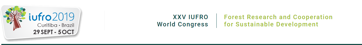
An audience of more than 2,800 people from more than 96 countries. More than 1,200 research projects presented in five plenary sessions, 19 sub-plenary sessions, 172 technical sessions, 350 scientific sessions, 1,648 oral presentations, and 1,200 posters. These are some of the key numbers from the XXVth IUFRO World Congress, the largest forest research event in the world, which was held for the first time in Latin America, in Curitiba, Brazil, from September 29 to October 5, 2019.
Remote sensing as an operational solution
Within the framework of this conference in relation with topics discussed within the framework of Theia Landscape and Biodiversity Scientific Expertise Centers (SECs) a session was organized in collaboration with Petteri Vihervaara (Syke, Finland member of GOBON network) under the title: “Improving conservation targets for forest biodiversity: towards operational solutions from remote sensing technology”. Twelve presentations were selected with a poster session exhibiting more than 30 posters presenting state-of-the-art, challenges and opportunities of remote sensing and coupling modelling for forest biodiversity monitoring and system understanding as well as highlighting examples in different regions of new capabilities on coupling remote sensing, different instruments, field observation and models.
Rationality of the Technical session
The preservation of biodiversity has become a major challenge for sustainable development from local, national to global levels. To address the current conservation needs and requirements, we need operational methods to assess the distribution of natural resources while integrating information on habitat condition to inform conservation planning and support the assessment of ecosystem services. Increased access to satellite imagery and new developments in data analyses can support progress towards biodiversity conservation targets by stepping up monitoring processes at various spatial and temporal scales.
Remote sensing has emerged as a fundamental data provider and method to analyze forested surfaces and monitor stressors, pressures and changes. The different presentations highlighted the variety of sensors available and the ability to develop original methods to use and combine information resulted in many forest ecology applications: the availability of image archives (Landsat), the development of new satellite constellations (Copernicus), as well as cutting-edge technologies such as imaging spectroscopy all contribute to global monitoring of forest ecosystems. Most of the cases presented and discussed highlighted the advances in LiDAR, hyper-spectral and RADAR that provide new perspectives on the possibility to accurately map phenology, species diversity, community distribution, leaf traits and biomass, contributing to filling the biodiversity data knowledge gap. All in all, remote sensing technologies coupling to modelling are leading opportunities to predict the consequences of changes in drivers at different scales and plan for more efficient mitigation measures in forested systems.

The contribution of alpha and beta mapping
At the IUFRO Technical Session on Remote Sensing, Maria Santos of the University of Zurich (Switzerland) presented the results of a study on alpha and beta diversity mapping conducted on a gradient of moist and dry forests in India using hyperspectral imagery (Huesca et al., 2019).
The authors compared supervised approaches, such as Random Forest, with unsupervised methods similar to the one proposed in biodivMapR (uRead next page) in order to determine the optimal spatial scale of analysis, which in this case corresponds to 1 hectare.
The figure above shows the results obtained for beta diversity mapping, illustrating the composition gradients of species communities from the unsupervised approach based on the spectral variability hypothesis (Asner et al. 2017).
Further reading
Margarita Huesca, Maria J. Santos, Raman Sukumar, Susan L. Ustin. 2019 Biodiversity assessment in a tropical deciduous forest in Mudumalai National Park in India using AVIRIS-NG data2019. p. 610 In XXV IUFRO World Congress Forest Research and Cooperation for Sustainable Development. Pesq. flor. bras., Colombo, v. 39, e201902043, Special issue, p. 1-768 2019 upfb.cnpf.embrapa.br/pfb/index.php/pfb/article/view/2043/900
Future priorities
Among several possible paths for future research the call from UNEP WCMC, presented by William Simonson from Climate Change and Biodiversity Programme, the followings must be highlighted:
- A global, systematically-developed dataset categorizing forest areas into natural or planted forests
- Greater investment in systematic, long-term, on-theground monitoring of forest vertebrates and improved data sharing within the research community
- Advances in coupled models are needed to integrate field data and RS data at different scales.

Sandra Luques
INRAE |TETIS
Research Gate
@sandra.luques
Contributions
- Chair IUFRO Division 8 – Forest Environment
- Co-facilitator for
- Landscape SEC
- & Variables for biodiversity SEC
biodivMapR | Mapping Tropical Biodiversity Through Optical Imaging
biodivMapR is a package developed in R language to produce biodiversity indicator maps from information derived from optical imaging data. The calculated diversity indicators are associated with the α and β components of biodiversity and make it possible, in particular, to map indicators of richness and abundance, such as the Shannon index, and indicators of species community distribution expressed by Bray-Curtis dissimilarity. These diversity indicators are calculated from the spatial heterogeneity of spectral information (Spectral Variation Hypothesis) and have shown good agreement with information collected in the field using forest inventories.
biodivMapR builds on the demonstrated potential of optical imaging data to estimate biodiversity indicators in tropical forest environments. Notably, airborne hyperspectral imagery data have been used in several independent research studies and are currently being used in national ecological observatories. The availability of Sentinel-2 multispectral optical data allows the transposition of existing methods for monitoring on a regional scale to be considered. This is what biodivMapR proposes. Although initially developed for the study of tropical forests, its application to other types of environments is also possible.

The tool
All codes, installation instructions and a biodivMapR tutorial are available on a dedicated web page:
jbferet.github.io/biodivMapR/index.html
The initial method is presented in the following publication: Féret, J.-B., Asner, G.P., 2014. Mapping tropical forest canopy diversity using high-fidelity imaging spectroscopy. Ecol. Appl. 24, 1289–1296.
doi.org/10.1890/13-1824.1
Developments in the method and operation of biodivMapR are presented in the following publication: Féret, J.-B., de Boissieu, F., 2019. biodivMapR: an R package for α- and β-diversity mapping using remotely-sensed images. Methods Ecol. Evol. 00:1-7.
doi.org/10.1111/2041-210X.13310
The development of biodivMapR was made possible by the financial support of the CNES TOSCA funding program (HyperTropik and HyperBIO projects) and the French National Research Agency (BioCop project-ANR-17-CE32-0001).
/pfb/index.php/pfb/article/view/2043/900
Providing information on essential variables for biodiversity
By contributing to the effective monitoring of ecosystems and the operationalization of monitoring methods with the support of available Earth observation means, biodivMapR contributes to the work of the Variables for Biodiversity SEC. The Essential Variables for Biodiversity (EBVs), defined by GEO-BON, aim to document the various factors at work in the erosion of biodiversity, which is particularly marked and worrying in tropical forest environments.

Jean-Baptiste Féret
INRAE | TETIS
@JB.Feret

Florian de Boissieu
INRAE | TETIS