Challenges & Research issues
The study of continental surface water is doubly important, as it represents the majority of water resources available to society in general (drinking water, agriculture, industry and leisure activities) and because its study reveals many of the processes at work within catchment areas (e.g. changing rainfall patterns, soil erosion, changes in land use and diffuse or specific pollution). Water resources thus act as sentinels for global and environmental change. In fact, changes in the water cycle (exceptional flooding, droughts and pollution) are often the most visible signs alerting our society to ongoing changes.
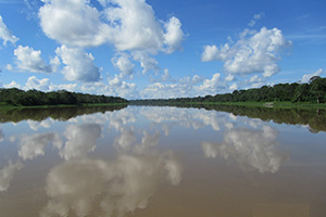
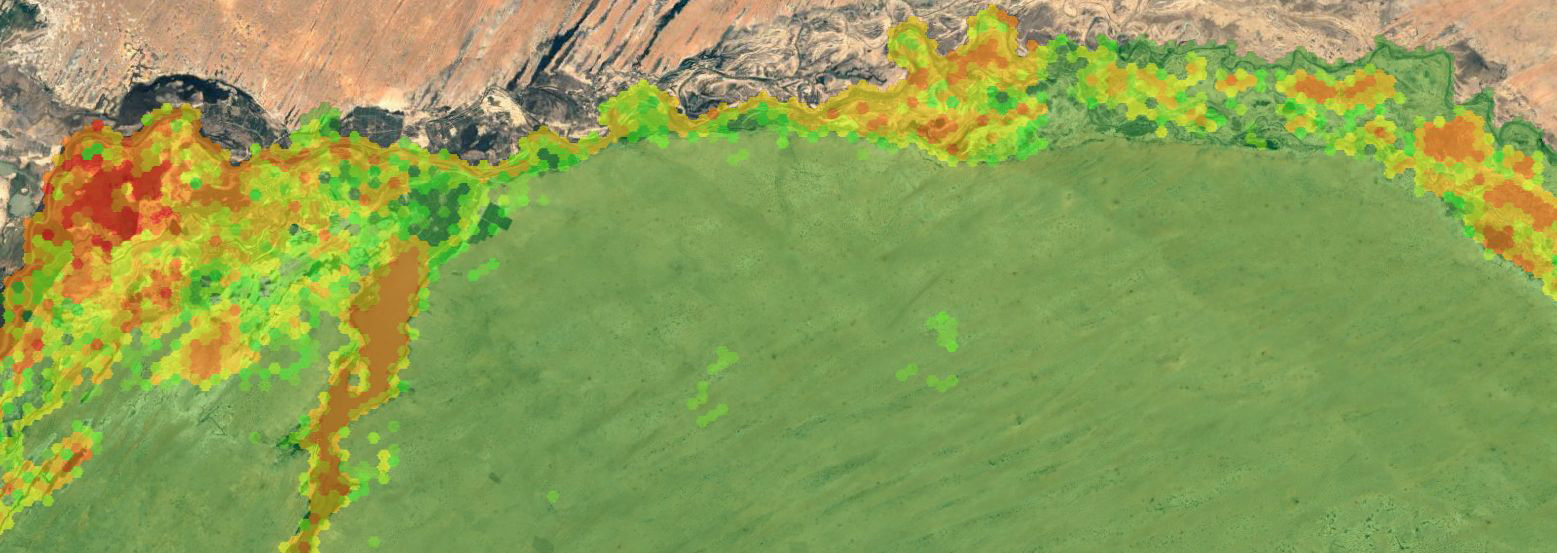
Solimões river in Brazil © J.M.Martinez
Monitoring hydrological processes requires repeated observations in space and time so as to detect the sources and modes of transport of the flows of water and material in catchment areas. As hydrological processes are highly heterogeneous by nature, the higher the frequency of observations, the more reliable they are and the more information they provide. Carbonneau and Piégay (2012) observe that the need to study and measure catchment areas holistically naturally leads to remote sensing as a fundamental tool, because only satellite data provide continuous measurements at the scale of the whole catchment area.
There are currently many techniques for studying the water cycle by remote sensing, especially over land, but this is a recent development and the discipline is therefore among the most dynamic of remote sensing applications. As a result, the techniques employed are extremely varied, and include active radar techniques, in which the phase (interferometry) and/or the power of the electromagnetic wave transmitted (SAR, altimetry) are taken into account; passive radar (microwave emissivity of surfaces); laser techniques; or spectral analysis at short wavelengths (multi-, super- or hyperspectral imaging in the visible and infrared). However, while there are an increasing number of satellite missions and applications, they must be geared to the issues facing hydrologists and managers of water resources. The people developing remote sensing tools are very often not those using them, and despite the spectacularly « demonstrative » nature of many remote sensing studies, their actual usefulness for those working in the field may be questionable. There is therefore a need for a concerted effort to develop robust products that address the problems faced by research, management and society at large.
The first satellite studies in hydrology initially focused on the observation of processes related to the transfer of water and material in catchment areas, but without directly observing the water itself. There have been many studies since the 1970s on the use of remote sensing for studying the geomorphology of watercourses (Millington and Townshend 1986), surface deformations (Wegmüller et al. 1998), changes in land use (Matthews 1983) or the use of microwave emissivity to estimate soil moisture content (Schmugge and Jackson 1994). Technical progress and the availability of new data sources have given birth to numerous applications. It is now possible to monitor hydrometeorological flows, including snow cover (Papa et al. 2007), the distribution of flooded plains (Hess et al. 2003; Martinez and Le Toan 2007), variations in water masses (Frappart et al. 2005; Papa et al. 2008), and the water level of rivers (Santos da Silva et al. 2010). It is now possible to “look into » watercourses and lakes. Very-high-resolution sensing has had a revolutionary effect by making it possible to map bathymetry phenomena in small watercourses (Fonstad and Marcus 2005), micro-habitats (Marcus et al. 2003) or even river beds (Carbonneau et al. 2005) with the use of passive optical or lidar imaging. The present is therefore an exceptional moment in terms of technical developments, and will hopefully lead to great progress in water cycle research themes. In particular, it is certain that the synergy between space observation, in situ observation and modelling tools will enable us to address fundamental questions related to the transfer of water and matter from the physics of small-scale processes right up to climate forecasting.
Theia Products on Water issues


")


Concerned Theia SECs
Prototyping SEC
Colours of the continental waters SEC
Scientific expertise
Digital Soil Mapping
Incubating SEC
Drought SEC
Scientific expertise
Evapotranspiration
Incubating SEC
Irrigation SEC
Producing SEC
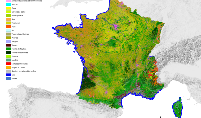
Land cover SEC

Incubating SEC
Mapping and monitoring of water bodies SEC
Producing SEC
Risks associated with infectious diseases SEC
Scientific expertise
Snow-covered surface
Producing SEC
Soil moisture with very high spatial resolution SEC
Scientific expertise
Surface Reflectance
Producing SEC
Surface Soil Moisture SEC
Prototyping SEC
Surface water volumes of floodplains SEC
Producing SEC
Water levels of lakes and rivers SEC
Theia News on Water
News
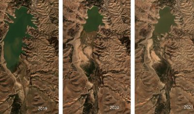
SWOT data that exceeds expectations
The SWOT space mission was launched at the end of 2022 by CNES and NASA to document the water masses of the entire planet – oceans and continental waters. Data […]
Products
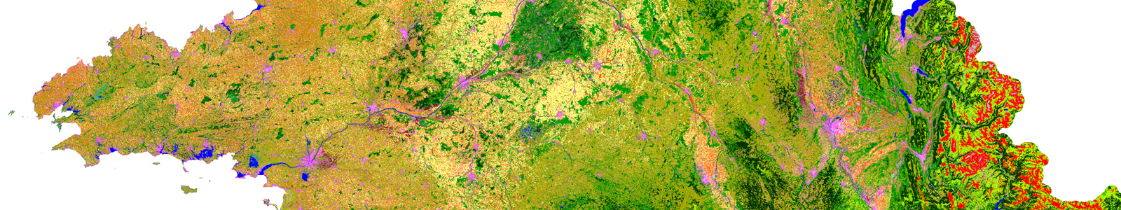
OSO 2023 Data : a little more patience ahead
THEIA Land Cover product is produced each year by CESBIO and CNES. It provides a 24-class typology of land cover, downloadable by department for mainland France. Production begins in January […]
Products
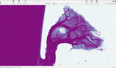
THEIA Sentinel-2 Surfwater, now an active production on hydroweb.next
Discover Theia Surfwater Product now produced continuously for Sentinel-2 and available on hydroweb.next
Products
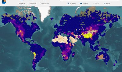
New Dissemination Portal for THEIA River and Lake Water Level Products – HYDROWEB
Discover the new hydroweb.next portal, which now include Theia Lake and River Water Level Products, Hydroweb
Applications
The study of water resources is a largely interdisciplinary field. Consequently, the products developed in the framework of the Theia cluster are designed to be used in delivery structures observing catchment areas in all their complexity and over the long term. A significant example of an application follows.
- The HYBAM National Observation Service investigates the hydrology and geochemistry of the Amazon Basin (www.ore-hybam.org). This SNO is tasked with observing the long-term evolution of the major Amazonian watercourses and understanding the hydrological variability and transfer of materials in relation to climatology and anthropogenic activities. It has been using satellite observations such as altimetry and colour for several years to supplement the observations of conventional networks. HYBAM is supported by an international consortium representing eight countries and consisting of partners in both research and operational hydrology (a hydro-weather service).