Natural Risks
Developing tools adapted to the entire crisis management cycle: vulnerability analysis, hazard mapping, rehabilitation and long-term prevention.
Using satellite imagery to establish a link between the environment, the habitats that are favourable to these species, and the human and animal populations at risk
Annelise TRAN, CIRAD researcher and THEIA Risks associated with Infectious Diseases SEC, shares her vision of Theia consortium, its achievements as well as the challenges ahead.
Huge Success for the French-Lebanese Summer School on Remote Sensing
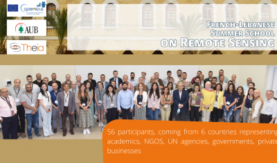
Theia-AUB Summer School in Beirut has been a huge success. All presentation and teaching material are now on-line.
“What motivates my interest in THEIA, but also in the very idea of data consortia, are the ever-changing activities and the associated challenges.”
Arnaud Sellé, CNES-Partner Interoperability Manager for DINAMIS, Theia & ForM@Ter, gives us his vision of Theia contributions and challenges.
AlTiS
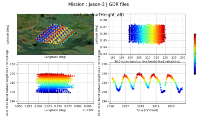
The AlTiS software allows the visualisation of altimeter data and the creation of water level time series on rivers, lakes and flooded areas.
May 30th to June 3rd 2022 | French Lebanese Summer School on Remote Sensing
A French Lebanese Summer School aiming to build capacity on Copernicus data and further academic relationships.
Do you know the SCO?
The SCO facilitators discuss the Space Climate Observatory project, through which several THEIA SECs and RANs projects have been labelled.
Land Cover on Reunion Island
An automated soil mapping system for Reunion Island, based on the Moringa chain, using Spot6/7 or Pleiades images.
Alex Storm and flash floods in the French Maritime Alps: Spatial imagery for crisis management
SERTIT laboratory explains how they respond to the need for rapid mapping during an event such as the Alex storm that devastated the Alpes-Maritimes at the end of 2020.
SMOS L4RZSM, an operational product dedicated to root zone humidity
Discover or rediscover the Root Zone Moisture product developed at Cesbio from SMOS data for Theia Surface Soil Moisture SEC.
GeoDEV: six thematic sheets for users in the South
Theia GeoDEV RAN proposes thematic sheets with Southern users’ needs in mind.
Hydroweb counts now over 11000 stations
Hydroweb last version offers data from more than 11000 virtual stations as well as more validation information.