Softwares & Tools

  • Data & Products (12)
  • Posts (1)
  • Pages (1)

Publications

Two THEIA LiDAR tools for forest monitoring

Softwares & Tools

lidarHD | an R package to manage and download HD lidar files

Softwares & Tools

Iota²

Fototex results

Softwares & Tools

Fototex

FOTOTEX, developed within Theia Risks Associated with Infectious Disease Risks and Urban SECs, proposes a unique, rapid and unsupervised method for characterising urban areas at three overlapping scales.

Montpellier – Distribution spatiale du moustique Aedes albopictus vecteur de la dengue, du virus Zika, du Chikungunya

Softwares & Tools

ARBOCARTO | Predictive mapping tool for Aedes vector population densities

Software able simulate the population dynamics of Aedes albopictus and Aedes aegypti.

Ile de la Réunion – Distribution spatiale du moustique Aedes albopictus vecteur de la dengue (en rouge : densités fortes ; en vert : densités faibles).

Softwares & Tools

ALBORUN | Model of Aedes albopictus mosquito population dynamics, Reunion Island

Software enabling to simulate the population dynamics for tiger mosquito, Aedes albopictus, Reunion Island

Ile Maurice – Distribution spatiale du moustique Aedes albopictus vecteur de la dengue

Softwares & Tools

ALBOMAURICE: a predictive model for mapping Aedes albopictus mosquito populations in Mauritius

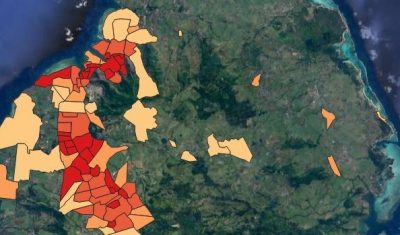
Software to simulate the population dynamics of the tiger mosquito, Aedes albopictus, in Mauritius.

Softwares & Tools

AlTiS

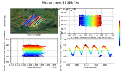
The AlTiS software allows the visualisation of altimeter data and the creation of water level time series on rivers, lakes and flooded areas.

Softwares & Tools

fordead | a python package for vegetation anomalies detection from SENTINEL-2 images

Softwares & Tools

BioDispersal

QGis PlugIn for computing ecological continuities

Softwares & Tools

FragScape

QGIS PlugIn to compute mesh effective size and thus quantify landscape fragmentation.

Softwares & Tools

Mapping and Modelling Tools for Preventing Infectious Disease Risk

Search