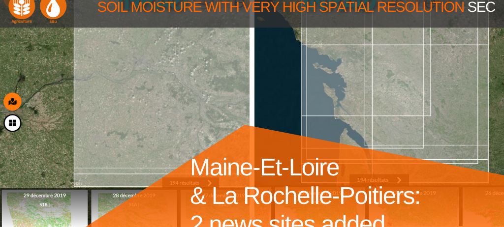
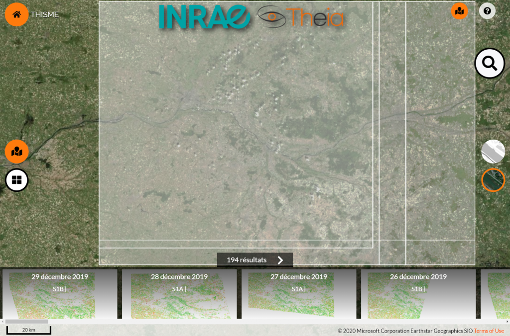
VHSR Soil Moisture: 2 new sites added
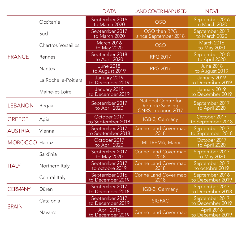
The Soil Moisture with Very High Spatial Resolution SEC offers now map series for two new sites in France: Maine-Et-Loire and La Rochelle-Poitiers. With these 2 additions, a total of 17 sites are covered by Theia VHSR Soil Moisture product.
- Maine-Et-Loire: 194 maps documenting soil moisture at plot scale from 01/01/2019 to 29/12/2019 :
search?q=%23Maine-Et-Loire&collection=SoilMoisture
- La Rochelle-Poitiers : 194 maps documenting soil moisture at plot scale from 01/01/2019 to 29/12/2019
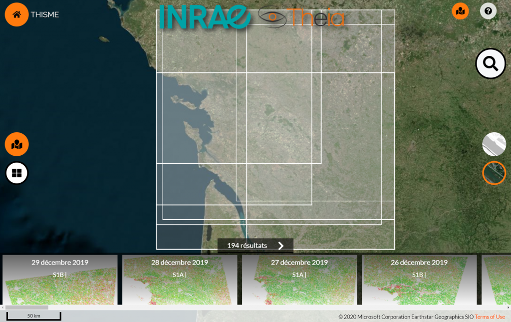
Soil moisture at plot level every six days
The VHR Soil Moisture product documents soil moisture at a plot scale every six days based on Sentinel-1 data. It is available for 17 sites in Europe and around the Mediterranean.
Registre parcellaire graphique (RPG)
National Center for Remote Sensing Lebanon
IBG-3 | Frank Hermann
Corine Land Cover | Copernicus
LMI TREMA Maroc | Vincent Simmoneaux
SIGPAC Espagne
Available data in September 2020
More about the product
Contact

Nicolas Baghdadi
INRAE | Tetis
ResearchGate
Contributions