[Post-Doc] Information content of remote sensing soil moisture retrievals for water resources and agricultural management
Main contact
- Laurent Longuevergne, laurent.longuevergne@univ-rennes1.fr
- Géosciences Rennes https://geosciences.univ-rennes1.fr/en
Partners
- Nicolas Baghdadi, UMR TETIS https://www.umr-tetis.fr/index.php/fr/
- Youssef Fouad, Didier Michot, UMR SAS, https://www6.rennes.inrae.fr/umrsas_eng/
- Nicolas Bellec, IMT Atlantique https://www.imt-atlantique.fr/en
Contract length 24 months
Earth Observations tools are widely developing, along with specific services for research and decision support. Beyond the opportunity to monitor the constant evolution of the Earth’s surface, one question remain: what is the actual information content of EO retrievals, and how to derive products to improve the understanding of natural processes and the predictability of models?
Soil moisture is a particular and interesting example. Several passive and active missions are sensitive to soil surface water content and provide shallow information on multi-kilometric grids. However, two important questions arise for the development and appropriation of such products:
- What is the meaning of such information while the typical scale of soil moisture variability lies at the intersection between the typical scales of water flow (hillslope ~1 km), and geological and vegetation heterogeneity (~100 m)?
- How to use such products for agricultural management and evaluation of water resources as they are representative for a limited portion of the soil thickness?
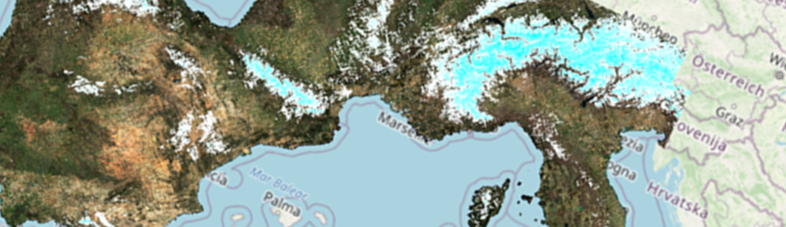
This project is based on a high spatial and temporal soil water content retrieval tool, developed by UMR TETIS (https://www.theia-land.fr/en/ceslist/soil-moisture-with-very-high-spatial-resolution-sec/). The algorithm relies mainly on the constellation of satellites from the European Copernicus program. It combines Sentinel-1 (radar, moisture sensitive) and Sentinel-2 (optical/NDVI, vegetation status) data within a neural network to estimate soil water content over a thickness of ~5 cm with an accuracy of ~5% by volume. The estimator is based on realizations of a physical model, calibrated on 10 years of data collected in different climatic and soil contexts. The approach is not sensitive to cloud cover. The singularity of this product remains its spatial resolution (a single parcel so ~100 m), relevant for agricultural and water resources management issues, and its temporal scale (2 days), relevant to capture flow dynamics.
The objective of this post-doc is threefold:
- Define the pertinence and added-value of high-resolution soil moisture with respect to classical products (SMOS, SMAP, ASCAT);
- Develop, set and validate a data-driven approach to extend surface soil moisture to root zone soil water content and estimate recharge, based on simple physical principles. This objective will be supported by ground observatories, where continuous observations of soil water content are available, and local agricultural and hydrological contexts are well described;
- Collaborate with modelers to design how high-resolution soil moisture products can contribute to improve model predictive skills.
This work is set in the wider context of BOSCO Space Climate Observatory project:
(https://www.spaceclimateobservatory.org/bosco-brittany), supported by the French Space Agency and the Brittany Region.
Candidate profile
Applicants should have a PhD degree in Environmental Sciences/Geophysics/Applied mathematics, Physics, or aclosely related field, with a keen interest in hydrology. The project will involve data processing/analysis, and programming skills are expected. Applicants should be a non-French native or a French with experience abroad within the last 18 months.
Proficiency in spoken/written English is mandatory, knowledge of French would be an advantage. Applications should include a CV, a statement of research interests and qualifications, academic transcripts and contact details of three academic referees in electronic form.