Data access
Presentation
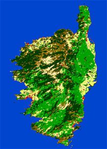
Global classes over Corsica
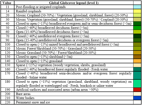
A land cover map associates to each pixel of the surface a labelling characterizing the surface (ex : deciduous forest, agriculture area, etc) following a predefined nomenclature. A commonly used nomenclature is the LCCS (Land Cover Classification System) used by FAO and UNEP, and comprising 22 classes.
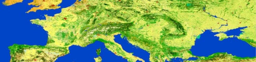
POSTEL produces and makes available the global land cover map at 300 m resolution of the GLOBCOVER / ESA project, which can be viewed with a zooming capacity. Regional maps are also available with classes adapted to each bioclimatic area. Posters of these maps, like the Western Europe below, can be downloaded.
Format
The key concept of the classification scheme is to combine the high spatial consistency of classes delineation obtained from multispectral composite(s) with the great land cover discrimination provided by temporal profile analysis.
The underlying principles are :
- to adopt a regionally-tuned approach based on 22 bioclimatic area
- to use as input multispectral composites and reflectance time series
- to define a typology based upon the FAO LCCS and as much as possible compatible with the CORINE Land Cover product, GLC2000, Africover..
- to appoint international experts for the calibration and validation of the classification algorithm.
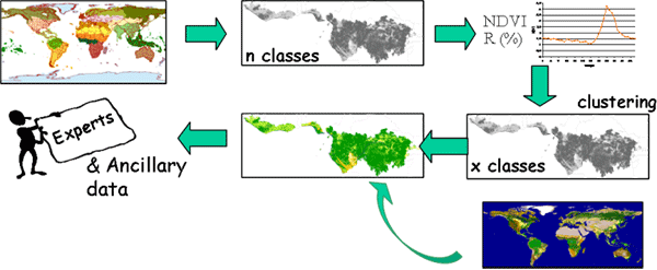
The classification scheme includes the following steps, as illustrated in the Figure above :
- a priori stratification of the world in 22 bioclimatic regions. In each of these regions, the same classification algorithm is applied.
- for each region, a per-pixel classification algorithm is applied using in input the time series of multispectral fortnightly mosaïcs, leading to n spectro classes
- for each pixel of n spectral classes, a temporal characterization is made to lead to a robust temporal metrics and spatially averaged
- the n classes are then clustered using this metrix in a smaller number x of consistent unlabelled spectro-temporal classes. At this stage, each pixel is associated to one of the x classes.
- a first labeling procedure, based on the GLC 2000 results, is subsequently applied to each of the x classes.
- the labeling procedure is finally updated to adapt to the specificities of the MERIS multispectral signal and to available ground truth with the help of a network of international experts.
The final 22 global classes are: