Thèse Morphologie et évolution sédimentaire de la Baie de Somme
Subject area: Sedimentology, Remote Sensing, Fluid mechanics, Data science.
Salary: 1450 net/month, with social security medical coverage
Duration: 3 years
Application deadline: 01st June 2022
Laboratories:
- UMR CNRS 6143 M2C (Coastal and Continental Morphodynamics), Université de Rouen Normandie, France. http://m2c.cnrs.fr
- UMR CNRS 8187 LOG (Laboratory of Oceanology and Geosciences), Université du Littoral Côte d’Opale, France. https://log.cnrs.fr/
Subject:
Coastal areas are strongly impacted by climate change (e.g., sea level rise, changes in storm regimes), which leads to changes in the frequency and intensity of flooding as well as coastline retreat. These consequences are well modelled at global scale, they remain complex to understand at local/regional scales. In this context, the development of coastal models is a major challenge for predicting responses to such disturbances and therefore adopting optimal risk management strategies.
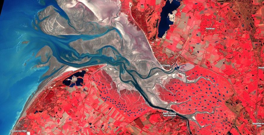
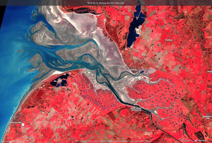
The Bay of the Somme (North of France), a system little impacted by man, is a sandy mouth in a mixed tidal and swell environment of the Eastern English Channel. The objective of this PhD thesis is to determine both the morphological and the sedimentary evolutions of this particular coastal system in response to hydro-meteorological and marine forcings by integrating multi-scale and multi-sensor measurements including:
- Topo-bathymetry: analyses of multi-spectral satellite images, airborne LiDAR and drone with hyperspectral and thermal cameras, LiDAR Terrestrial, bathymetric multibeam soundings and seismic measurements.
- Sedimentary cover: lab analyses on surface samples and short cores (including hyperspectral camera) and in situ radiometric measurements.
- analyses of the evolution of hydrodynamic conditions by coupling re-analysis models (multi-decadal scale) and short-term field campaigns (monthly scale).
This methodological coupling will make it possible to: (i) Assess the sediment accretion/erosion rates and their spatio-temporal variability, (ii) characterize the evolution of the sediment coverage into the 3 spatial dimensions, and (iii) calculate the sediment budget. In addition, results will also help to calibrate/validate hydro-sedimentary numerical models specifically designed for the Bay of the Somme.
Profile:
Training in earth sciences, and in particular in sedimentology, hydrodynamics/fluid mechanics and/or sediment dynamics. Knowledge of coastal environments. Experience in remote sensing analysis and/or in situ measurements is required to apply for this position.
In order to apply to this position, please send your CV and cover letter to: