
Accès à la donnée
Présentation du produit
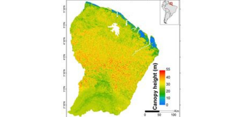
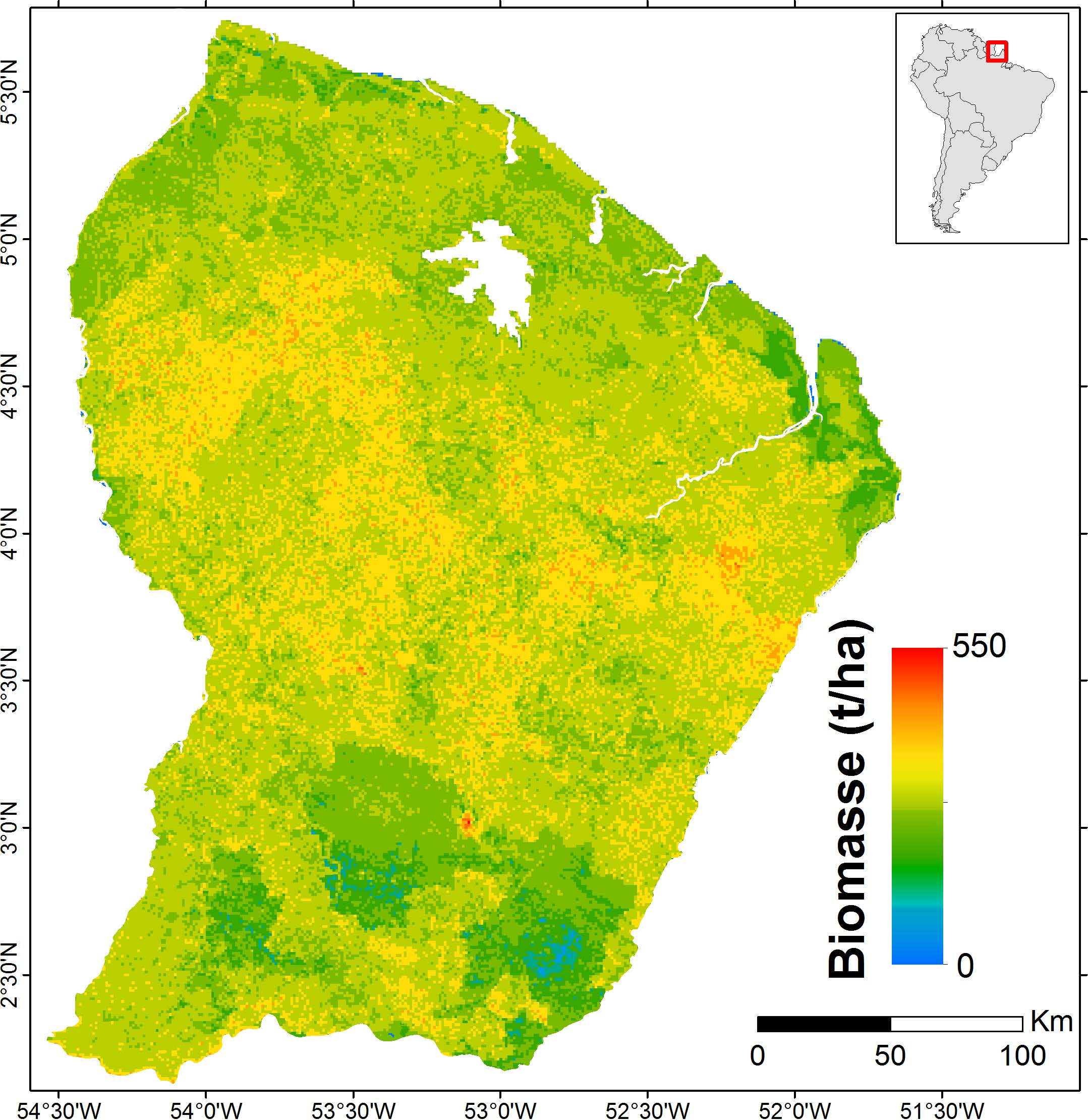
La carte est obtenue par fusion de données LiDAR, radar, optiques et d’autres jeux de données environnementales. La précision de cette carte, si on la compare à des estimations terrain, est de l’ordre de 50 t/ha (l’erreur moyenne absolue = 12%).
Auteurs
Ibrahim Fayad (Irstea), Nicolas Baghdadi (Irstea), Stéphane Guitet (ONF), Jean Stéphane Bailly (AgroParisTech), Nicolas Barbier (IRD), Valéry Gond (CIRAD), Bruno Hérault (CIRAD), Mahmoud El Hajj (Noveltis), Frédéric Fabre (Astrium/EADS), José Perrin (BRGM)
Remerciements
IRSTEA, CNES (TOSCA), BRGM, CIRAD, IRD, CNRS, Noveltis, Astrium/EADS, NSDIC (National Snow and Ice Data Center for the distribution of the ICESat/GLAS data), ONF.
Contact

Nicolas Baghdadi
INRAE | Tetis
ResearchGate
Contributions
Format
Metadata
- GeoTIFF raster
- NoData: -9999
- EPSG: 32622
- Resolution: 1000 m
- Pixel type: double precision (64 bits)
Dates des données
- ICESat: 2003-2009
- BRGM: 1996
- Altoa: 2004-2009
- Données optique: 2003-2013
- SRTM: 2000
- Données Géologique: 2001
Référence
Fayad I., Baghdadi N., Guitet S., Bailly J.S., Hérault B., Gond V., El Hajj M., and Ho Tong Minh D., 2016. Aboveground biomass mapping in French Guiana by combining remote sensing, forest inventories and environmental data, International Journal of Applied Earth Observation and Geoinformation, vol. 52, pp.502-514, http://dx.doi.org/10.1016/j.jag.2014.04.005.
Forest biomass map in French Guiana / Fayad, I., Baghdadi, N., Guitet, S., Bailly, J.-S., Barbier, N., Gond, V., Hérault, B., El Hajj, M., Fabre, F., Perrin, J. (2018). Forest biomass map in French Guiana. Irstea. https://doi.org/10.17180/forest-biomass-fr-guiana-map-2016