GeoGEDI
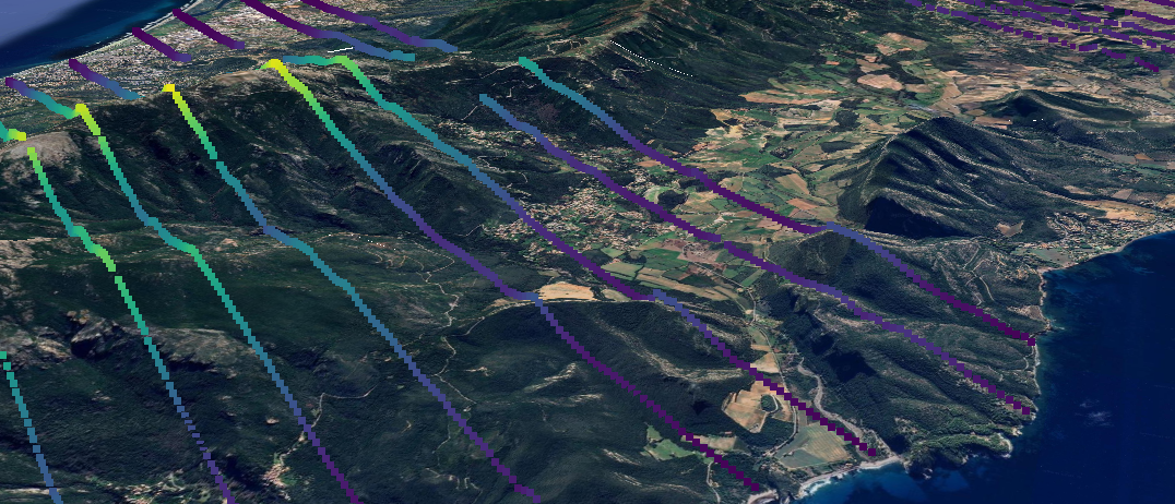
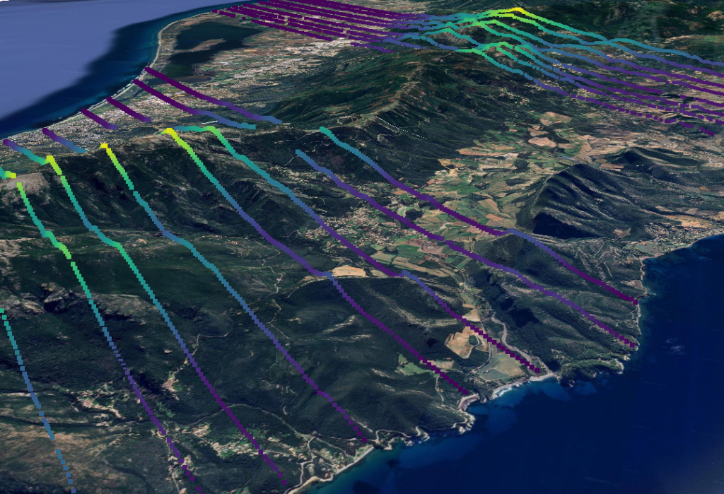
Séries temporelles GEDI (Global Ecosystem Dynamics Investigation) d’élévation et métriques de hauteur (L2A) avec géoréférencement des empreintes amélioré pour la France métropolitaine, 2019-2023. Ces séries sont traitées pour améliorer le géoréférencement des données par le CDS THEIA-MTD de Montpellier.
Les variables thématiques des séries GeoGEDI ont été avant tout choisies pour répondre aux besoins de l’étude des zones forestières :
- élévation du sol,
- hauteur de canopée
- 01 hauteurs correspondant aux pourcentages d’énergie cumulée de la forme d’onde en partant du bas (RH0) vers le haut (RH100).
Licence : etalab-2.0
Ressources
Les données peuvent être téléchargées et visualisées sur le catalogue du CDS THEIA-MTD
Le code de traitement est ouvert et disponible sur https://github.com/aschleich/GeoGEDI . La méthode et les codes sont donc disponibles pour traiter d’autres zones si besoin.
Références
[1] Schleich, A., Bouriaud, O., Vega, C., & Durrieu, S. (2024). Showcasing the effectiveness of GEDI footprints as first-phase sample for forest inventories based on double sampling for post-stratification. Authorea Preprints, 2024 – techrxiv.org,
[2] Yang, C., Peng, D., Deng, K., Jiang, L., Zhao, M., Zeng, W., … & Wang, N. (2024). Quantification of GEDI Geolocation Error and its Influence on Elevation and Canopy Height. IEEE Journal of Selected Topics in Applied Earth Observations and Remote Sensing.
[3] Quiros, E., Polo, M. E., & Fragoso-Campón, L. (2021). GEDI elevation accuracy assessment: a case study of southwest Spain. IEEE Journal of Selected Topics in Applied Earth Observations and Remote Sensing, 14, 5285-5299.
[4] Schleich, A, 2024, Apport du lidar spatial pour le développement de méthodes d’inventaire forestier multisource adaptées à la gestion durable des forêts dans un contexte de changement global, Thèse de doctorat, AgroParisTech- ED GAIA, chapitre 3, pp. 39-61
[5] Roy, D. P., Kashongwe, H. B., & Armston, J. (2021). The impact of geolocation uncertainty on GEDI tropical forest canopy height estimation and change monitoring. Science of Remote Sensing, 4, 100024.
[6] Potapov, P., Li, X., Hernandez-Serna, A., Tyukavina, A., Hansen, M. C., Kommareddy, A., … & Hofton, M. (2021). Mapping global forest canopy height through integration of GEDI and Landsat data. Remote Sensing of Environment, 253, 112165.
[7] Shendryk, Y. (2022). Fusing GEDI with earth observation data for large area aboveground biomass mapping. International Journal of Applied Earth Observation and Geoinformation, 115, 103108.
[8] Schwartz, M., Ciais, P., De Truchis, A., Chave, J., Ottlé, C., Vega, C., … & Fayad, I. (2023). FORMS: Forest Multiple Source height, wood volume, and biomass maps in France at 10 to 30 m resolution based on Sentinel-1, Sentinel-2, and Global Ecosystem Dynamics Investigation (GEDI) data with a deep learning approach. Earth System Science Data, 15(11), 4927-4945.
[9] S. Hancock et al., “The GEDIsimulator: A large-footprint waveform lidar simulator for calibration and validation of spaceborne missions,” Earth Space Sci., vol. 6, no. 2, pp. 294–310, 2019, doi: 10.1029/2018EA000506.
[10] Schleich, A., Durrieu, S., Soma, M., & Vega, C. (2023). Improving GEDI footprint geolocation using a high-resolution digital elevation model. IEEE Journal of Selected Topics in Applied Earth Observations and Remote Sensing, 16, 7718-7732.

Sylvie Durrieu
INRAE |TETIS
ResearchGate | HAL