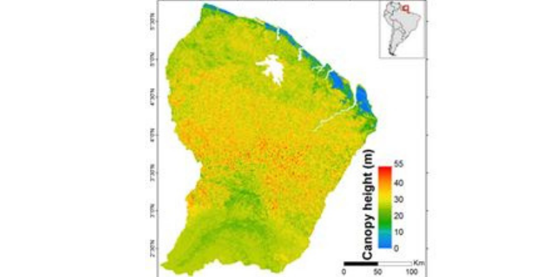
Hauteur de la canopée à 1 km pour la Guyane française
Produit de démonstration dont les caractéristiques sont :
Données : ICESat: 2003-2009, BRGM: 1996, Altoa: 2004-2009, Données optiques : 2003-2013, SRTM: 2000, données géologiques : 2001
Résolution : 1km
Couverture : Guyane française
Ressources :
- Fayad I., Baghdadi N., Bailly J.S., Barbier N., Gond V., El Hajj M., Fabre F., and Bourgine B., 2014. Canopy height estimation in French Guiana with LiDAR ICESat/GLAS data using principal component analysis and random forest regressions, Remote Sensing, vol. 6, pp.11883-11914, doi:10.3390/rs61211883.
- Canopy height in French Guiana : Fayad, I., Baghdadi, N., Bailly, J.-S., Barbier, N., Gond, V., El Hajj, M., Fabre, F., Bourgine, B. (2018). Canopy height in French Guiana. Irstea. https://doi.org/10.17180/canopy-height-fr-guiana-2014