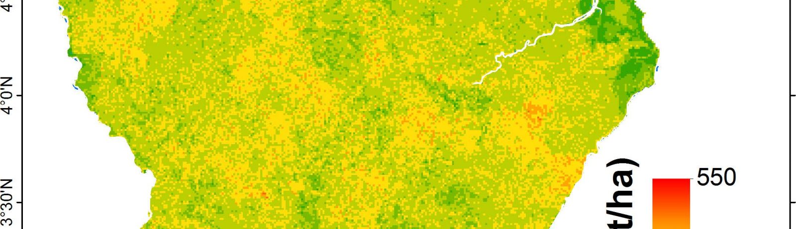
Biomasse à 1km sur la Guyane française
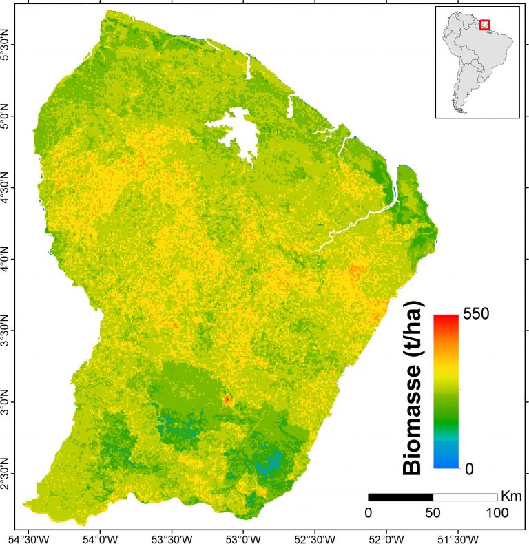
Carte de la biomasse sur la Guyane française, 2016
Produit de démonstration dont les caractéristiques sont :
Données : ICESat: 2003-2009, BRGM : 1996, Altoa: 2004-2009, données optiques : 2003-2013, SRTM: 2000, données géologiques : 2001
Résolution : 1Km
Couverture Guyane française
Références :
- Fayad I., Baghdadi N., Guitet S., Bailly J.S., Hérault B., Gond V., El Hajj M., and Ho Tong Minh D., 2016. Aboveground biomass mapping in French Guiana by combining remote sensing, forest inventories and environmental data, International Journal of Applied Earth Observation and Geoinformation, vol. 52, pp.502-514, http://dx.doi.org/10.1016/j.jag.2014.04.005.
- Forest biomass map in French Guiana / Fayad, I., Baghdadi, N., Guitet, S., Bailly, J.-S., Barbier, N., Gond, V., Hérault, B., El Hajj, M., Fabre, F., Perrin, J. (2018). Forest biomass map in French Guiana. Irstea. https://doi.org/10.17180/forest-biomass-fr-guiana-map-2016