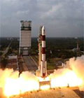
Launch of SPOT 7
The SPOT 7 Earth-observation satellite, designed and developed by Airbus Defence and Space, was launched successfully on 30 june 2014 from the space centre in India.
The company will thus operate a constellation of four optical satellites that will open up opportunities for new applications, providing the latest images within an unprecedented time frame. This means that every day, every point on the globe can be viewed both in high resolution by a SPOT satellite and in very high resolution by a Pléiades satellite. While SPOT 6 and 7 will cover wider areas with a resolution of 1.5 m, Pléiades 1A and 1B will be focused on more targeted zones with a greater level of detail (50 cm products).
More information on Launch of SPOT 7 completes Airbus Defence and Space observation satellite constellation