Theia (daughter of Ouranos – Heaven – and Gaïa – Earth) Data and Services centre for continental surfaces was created at the end of 2012 by 9 French public institutions involved in Earth observation and environmental sciences. The purpose of this scientific and technical structure is to facilitate the use of images resulting from the spatial observation of continental surfaces.
Theia provides the national and international scientific community and public policies aiming to monitor and manage environmental resources with a wide range of images at different scales, products, methods and training related to the observation of continental surfaces, particularly from space.
Three main objectives
- Building a common system capable of producing spatial data (local to global scale) with added value for the continental surface community and providing services in line with users’ needs,
- Encouraging experience sharing and methods capitalisation,
- Making French achievements visible at European and international level.
Theia articulates French skills in the field, pooling more than 400 laboratories and more than 100 doctoral schools throughout the country.
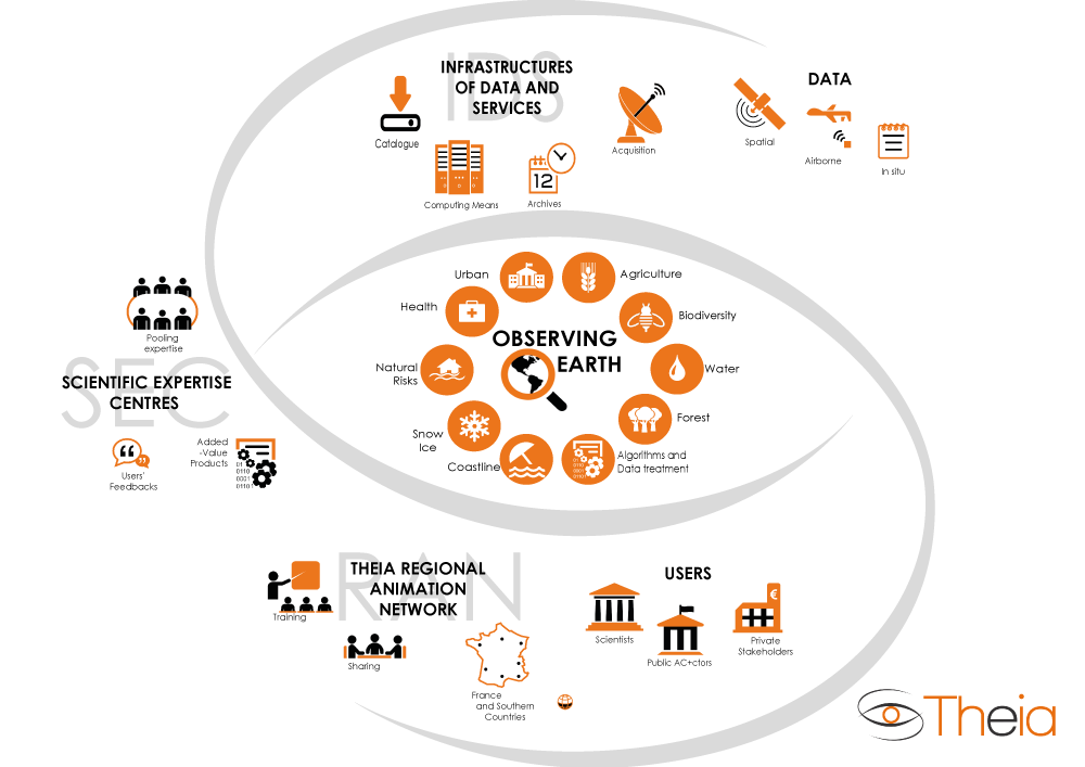
Spatial data, scientific expertise and animation network
The consortium lays upon three pilars
- a Spatial Data Infrastructure (SDI) distributed among several actors,
- a network of Scientific Expertise Centres (SEC),
- and Regional Theia Animation Centres (RAN) in the various metropolitan regions and French overseas territories as well as Southern Countries.
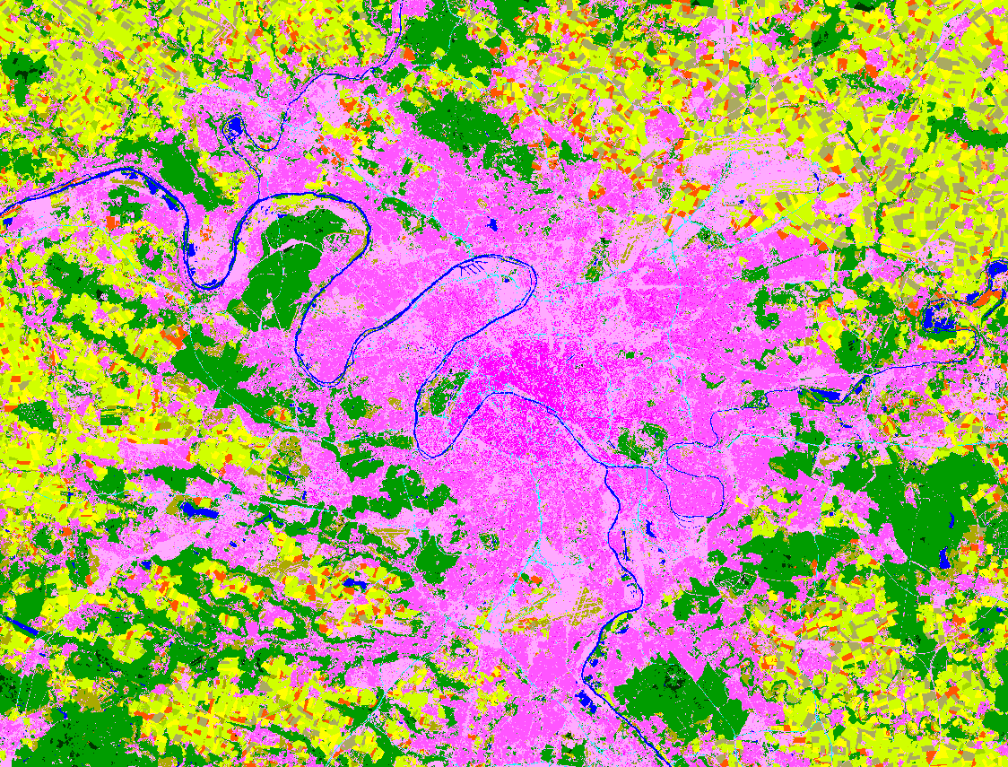
The products provided by Theia, of controlled quality, cover large territories and long periods: annual satellite image coverage of the national territory, surface reflectance time series, biophysical variables (biomass, water levels, surface humidity, etc.), data visualization and pre-processing tools, processing methods and algorithms, methodological guides for thematic applications.
Theia products allow you to:
- facilitate the measurement of the impact of anthropogenic pressures and climate on ecosystems and territories,
- observe, quantify and model water and carbon cycles,
- monitor changes in societies and their activities, in particular their urban, agricultural and forestry practices,
- understand the dynamics of biodiversity.
This infrastructure contributes to improving knowledge and supporting the development of applications resulting from thematic research relevant to public policies, for better sustainable management of territories, in all its dimensions, anthropogenic, ecological, agricultural.
Member of Data Terra as well as three other data centers
Theia is now one of the active members of the Earth System Research Infrastructure, Data Terra.