Sentinel-2B satellite launch
The ESA-developed Sentinel-2B satellite was launched on 7 March 2017, doubling the coverage of high-resolution optical imaging in the Sentinel-2 mission for the European Union Copernicus environmental monitoring system.
After the first ‘launch and early orbit’ phase, which typically lasts three days, controllers will begin checking and calibrating the instruments to commission the satellite. The mission is expected to begin operations in three to four months but the first image may be sent around the 15 march 2017
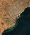
The optical imaging Sentinel-2 mission is based on a constellation of two identical satellites: Sentinel-2A, which was launched in June 2015, and Sentinel-2B. Although launched separately, the satellites are placed in the same orbit, flying 180° apart. Every five days, the satellites jointly cover all land surfaces, large islands, and inland and coastal waters between latitudes 84°S and 84°N, optimising global coverage and data delivery.
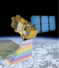
Each Sentinel-2 satellite carries an innovative high-resolution multispectral camera with 13 spectral bands for a new perspective of land and vegetation. The combination of high-resolution, novel spectral capabilities, a field of vision covering 290 km and frequent revisit times will provide unprecedented views of Earth.
Information from this mission is helping to improve agricultural practices, monitor the world’s forests, detect pollution in lakes and coastal waters, and contribute to disaster mapping.
For more information, see esa.int
More information: Sentinel-2