Sentinel-2A: New eyes of Copernicus ready for space
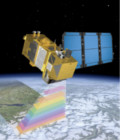
Sentinel-2A satellite, now fit for service, will map the Earth’s entire landmass as part of the European Copernicus global monitoring program.
After six months of intensive testing, the first Sentinel-2 satellite developed and built by Airbus Defence and Space for the European Space Agency (ESA) is getting ready for its mission in space.
Sentinel-2A will be the second satellite of the Copernicus programme to be launched. Copernicus is an operational programme led by the European Commission (EC) in partnership with the European Space Agency (ESA). The Copernicus Sentinels supply remote sensing data of the Earth to deliver key operational services related to environment and security.
More information on http://airbusdefenceandspace.com