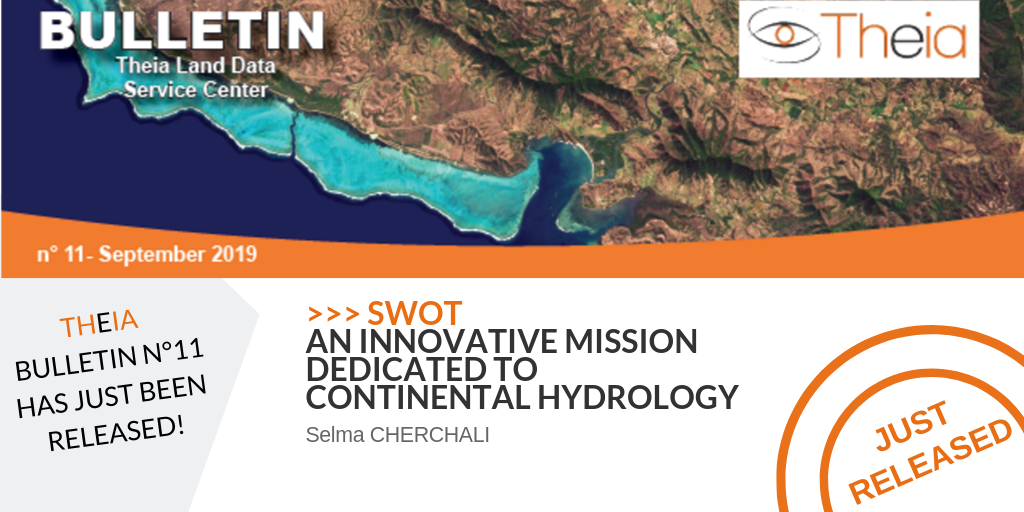
SWOT: an Innovative Mission Dedicated to Continental Hydrology
Meeting the needs of hydrologists and oceanographers
SWOT (Surface Water Ocean Topography mission) is a research mission proposed by NASA as part of the Decadal Survey of its Earth Observation program. It is also one of the high priorities of CNES further recommandations by the Scientific Program Committee following the CNES Scientific Prospective Seminar in Biarritz 2009. SWOT’s main objective is to bring together the needs of the hydrological and oceanographic communities in a single satellite, with the collection of unique oceanographic and hydrographic data on a global scale including the shoreline and coastal zone. SWOT thus aims to meet the challenges and societal demand in terms of water management. The increasingly precise description of the water cycle on land allows for better climate prediction and better control of the planet’s water resources (human consumption and activities such as agriculture, urbanization, hydroelectric power production, etc.). The monitoring of water resources on a global scale is a major societal challenge in which space technologies have a decisive role to play.
The SWOT mission will measure the water levels of oceans, rivers, lakes and flooded areas using a new technical concept: interferometric altimetry. Compared to conventional altimetry, which provides point data along profiles spaced several tens / hundreds of kilometres apart, wide-swath interferometric altimetry will be able to provide centimetric precision water heights, water body slopes and widths – for rivers over 100 m wide and rivers and lakes and reservoirs over 250 m2 – with a temporal resolution on a weekly basis. The applications of this mission are vast: flood prediction, surface water management for consumption, irrigation, river navigation, hydropower production, epidemic propagation, etc. for mesoscale circulation hydrology for oceanography.
Supporting Water Stakeholders
Supported by the French Future Investment Programme (Programme d’Investissment d’Avenir, PIA), CNES has set up the SWOT-aval programme to prepare water stakeholders for the arrival of future SWOT data, but also to raise their awareness of the use of space (Copernicus data in particular) in hydrology. The SWOT-preparatory program monitors and supports developments in the various Theia SECs: Land Cover (IOTA2 chain on West Africa); Water Quality (OBS2CO and sediment flow estimation combined with SWOT); Water Levels (Hydroweb); Snow-Covered Surface (LIS chain); Water Surfaces with the development of the SurfWater chain based on Sentinel-1 and 2; and finally Soil Moisture with SMOS and Sentinel-1. In parallel, the SWOT-aval programme is setting up Hydroweb-NG, a spatialized water information database that will centralize access to all space-based data and products in a single access point and be integrated into Theia.
These activities are carried out in collaboration with the TOSCA, various laboratories and Theia. This coordination and promotion of French scientific excellence is a real success have been acknowledged at both European and international level: Hydroweb is now integrated into the Copernicus Global Land and Copernicus Climate Change Services programme and participates in the Climate Change Service (CCI) on lakes; snow-covered areas will be integrated into the high resolution pan-European Snow and Ice layers of the Copernicus Land Monitoring Service.
The Congo Basin Example
In order to demonstrate the interest of space to downstream stakeholders, a Working Group on Space Hydrology bringing together CNES, IRD, Irstea, AFD, IOWater, BRLi and CNR was created in 2014. The Congo Basin was chosen as a pilot region. An agreement between the seven public and private institutions was signed at COP22 in Marrakech allowing for an agreement with CICOS, the Congo River transboundary basin agency. With AFD’s support this work allows CICOS to have an operational Hydrological Information System integrating Hydroweb’s spatial altimetry data and in-situ data. Spatial altimetry has also proved to be of great interest for the development of airworthiness prediction services and for the determination of an atlas of the basin’s hydropower potential.
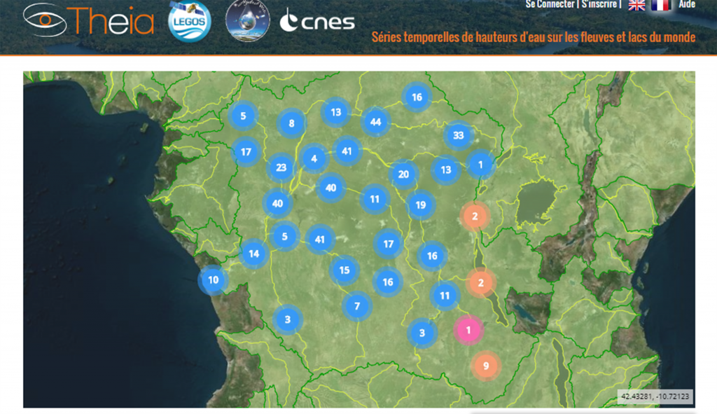
>> hydroweb.theia-land.fr/
The working group’s focus is now on other African basins, such as Niger, Chad and Senegal, where altimetry and other variables of interest in hydrology (land use, water quality, water surfaces, etc.) will be highlighted, in addition to altimetry.

Selma Cherchali
Cnes, SWOT et SWOT Downstream
Publication
Read the New Theia Bulletin
>>> Read on-line on Calaméo