QGIS in Remote Sensing
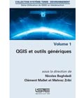
New series of books « QGIS in remote sensing »aims to facilitate the appropriation and operational use of the Quantum Geographic Information System (QGIS) software in the field of remote sensing. After the Land Surface Remote Sensing set, new series of 4 books on QGIS in remote sensing has just been published in french and english with ISTE-Elsevier editions coordinated by André Mariotti and edited by Nicolas Baghdadi and Mehrez Zribi.
- Volume 1 : QGIS and generic tools / QGIS et outils génériques (QGIS, GDAL, GRASS, SAGA, OTB)
- Volume 2 : QGIS and applications in agriculture and forest / QGIS et applications en agriculture et en foresterie
- Volume 3 : QGIS and applications in territorial planning / QGIS et applications en aménagement du territoire
- Volume 4 : QGIS and applications in water and risks / QGIS et applications en eau et risques
This work is carried out by scientists who are proficient to a high level of technicality. The book is targeted at students (Masters, engineering students, PhDs), engineers and researchers who have already adopted geographic information systems.
In addition to the text, readers will have access to data and tools allowing the integral realization of the scientific procedures described in each chapter, as well as screenshots of all the windows which illustrate the manipulations necessary for the realization of each application.
More details exist in these two sites iste.co.uk (english version) and iste-editions.fr (french version)
More information: SoftwareEducational resources