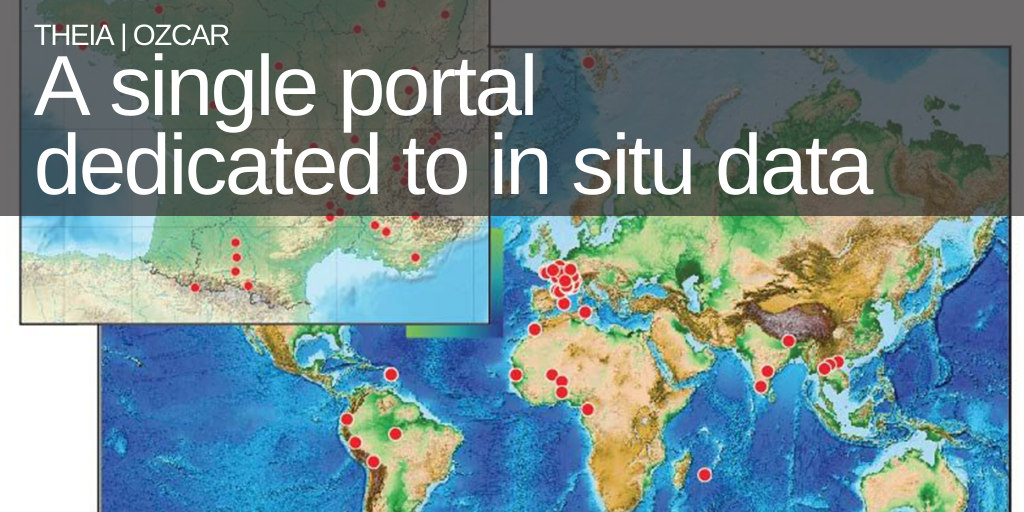
Theia|OZCAR: a single portal dedicated to in situ observation data

The objective of the Theia|OZCAR Information System is to make visible all in-situ observation data on continental surface collected by French research organizations and their partners in France and abroad.
The information system under construction will allow discovery (December 2019) and access to in situ data (June 2021) on a single portal, accessible via Theia, the French data and services center for continental surfaces data.
An innovative development
The development of the Theia/OZCAR Information System began with data from labelled observatories that are part of the OZCAR Research Infrastructure (RI) – Observatories of the Critical Zone: Observation and Research. It will then be extended to data from other sources (research programs, non-labelled observatories). The Information System under development is based on data exchange standards (INSPIRE, OGC) and is committed to implementing the FAIR principles.
READ THE ARTICLE IN THE THEIA BULLETIN N°10
At the French level, this project is carried out in coordination with Data Terra RI, of which Theia is a member, as well as Aeris, ForM@Ter and Odatis. Theia|OZCAR also contributes to preparing the French community to integrate European infrastructures such as eLTER-RI (European Long Term Ecological Research), registered on the European roadmap (2018) and whose French mirror eLTER-France includes OZCAR RI.
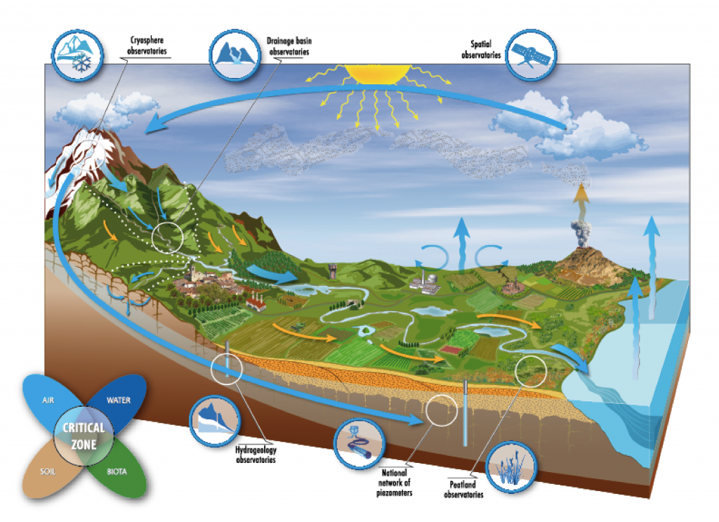
21 observatories around the world
OZCAR-RI coordinates 21 labelled observatories that manage around sixty sites in France and abroad (North and West Africa, Asia, South America, the Arctic) ranging from a few hectares to several hundred km².
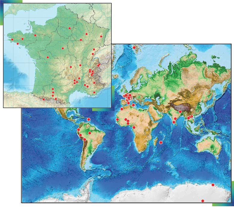
Maps published in Gaillardet et al., 2018. OZCAR: The French Network of Critical Zone Observatories. Vadose Zone Journal, 17(1). DOI:10.2136/vzj2018.04.0067
These observatories collect in situ data concerning land surfaces over the long term, some of which start as early as 1960. In the current census there are more than 300 different variables measured by OZCAR-RI observatories (including both physical variables and chemical species) whose names have been harmonized. In situ data are mainly time series, but also gridded data, vector data, or 2D profiles. A test version of the portal, targeting time series, will be delivered in December 2019.
The development of the Theia|OZCAR information system is supported by the CNRS-INSU, the IRD and the ANR FairTOIS “Implementing the FAIR principles in the Theia|OZCAR information system”.
A dedicated team
Scientific Manager
Theia|OZCAR IS

Sylvie Galle
IRD |
Chargée de mission CNRS Insu
ResearchGate | ORCID
Technical Manager
Theia|OZCAR IS

Véronique Chaffard
IRD
@V.Chaffard