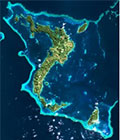
First images from SPOT 7 satellite
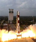
SPOT 7 satellite has shown its first images obtained a mere three days after its launch on 30 June 2014.
the last few hours, the entire chain – from satellite programming and image acquisition to telemetry reception and processing – was successfully put into operation to deliver these first spectacular images. These images show highly diverse landscapes, revealing SPOT 7’s full potential in terms of natural resource and urban zone mapping and agri-environmental monitoring.
Discover First images from SPOT 7 satellite