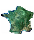
2014 Spot 6/7 national coverage provided by Geosud
The complete 2014 Metropolitan France coverage made from SPOT6 / 7 satellite images is available for download on the Equipex Geosud portal.
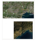
It includes 1.5 meters resolution images orthorectified by the IGN, the french national geographic institute. The Orthoimages comply the French large-scale base map of reference (RGE) from IGN. The vesting period covers 22 metropolitan areas over the period from March to October.
The 2014 coverage is available for free download to all Geosud adherents. The application procedure is similar to previous ones.
This annual coverage of France is to be reproduced and made available every year. The new Geosud direct receiving station in Montpellier must meet this challenge in 2015.