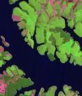
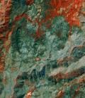
A new version of Spot4 (Take5) products is available

The THEIA Land Data center just released the version 2.0 of SPOT4 (Take5) time series.
 
This data set provides time series of SPOT4 images acquired every 5th day over 45 sites, between February 2013 and June 2013.
 
The obtained time series simulate the time series that Sentinel-2 will deliver. The data were produced at MUSCATE production center, and are available here.
 
The new features of this version are described on the blog dedicated to the SPOT4 (Take5) experiment, as well as the product format which slightly evolved..More information: 
More news

AlTiS-NG GUI with Jason-2 mission on the Komadugu river, Niger

AlTiS-NG: A new tool for analysing altimetry data in hydrology

Discover AlTiS-NG, THEIA new hydrological altimetry software presented on Tuesday 24 June on the Data Terra stand at the LPS.

Data Terra, a major data player, awaits you at the Living Planet Symposium 2025

Join Data Terra at the heart of innovation at the Living Planet Symposium 2025! From June 23 to 27 in Vienna.

Engineer in remote sensing applied to monitoring tropical forest ecosystems

The INRAE offers a remote-sensing engineer position in TETIS laboratory, Montpellier, France.

Search