Canopy height for French Guiana
A canopy height for French Guiana obtained using the data fusion of LiDAR, optical and other environmental datasets.
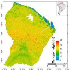
A canopy height for French Guiana obtained using the data fusion of LiDAR, optical and other environmental datasets.
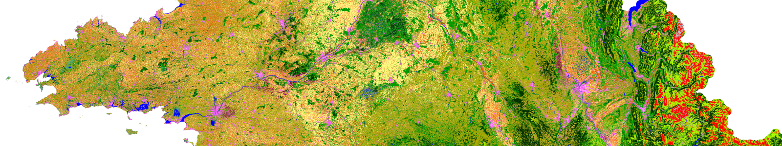
National scale maps with 17 (2016,17) and 23 (2018) class nomenclature, spatial resolution between 10 m (raster) and 20 m (vector), annual update frequency.
Data access Presentation This biomass map has a spatial resolution of 250m x 250m and was obtained using the data fusion of LiDAR, optical and other climatic datasets. The precision […]
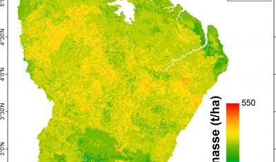
Biomass map for French Guiana obtained using the data fusion of LiDAR, radar, optical and other environmental datasets.