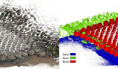
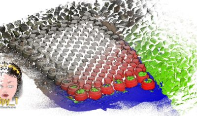
Softwares & algorithmes cLASpy_T | Tools for classification of LAS file with python and machine learning algorithms’ or classification LAS python Tools. cLASpy_T classifies 3D point clouds using machine learning. The software is particularly well suited to monitoring coastal environments.
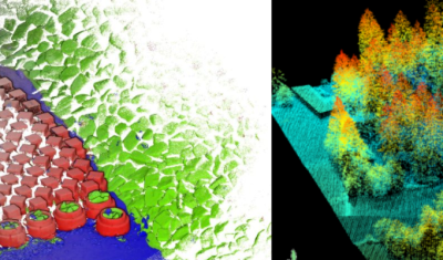
Softwares & algorithmes lidaRtRee | an R package providing forest analysis tools lidaRtRee is an R package that provides functions for forest analysis using airborne laser scanning (LiDAR remote sensing) data: