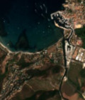
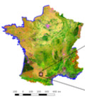
First land cover map of France for 2016 from Sentinel-2

The first land cover classification map of Metropolitan France for 2016 made from Sentinel-2 data at 10m resolution was released by the Land cover Scientific Expertise Centre on the 30th of March 2017.

For more information, see http://osr-cesbio.ups-tlse.fr

More information: Land cover mapLand cover CESSentinel-2

More news

Engineer in remote sensing applied to monitoring tropical forest ecosystems

The INRAE offers a remote-sensing engineer position in TETIS laboratory, Montpellier, France.

SWOT : Understanding Our Rivers, Lakes and Floodplains

Two years after the launch of the French-American SWOT mission, what progress has been made in monitoring continental waters ?

NEW PRODUCTION AND DISTRIBUTION MEANS FOR THE CNES THEIA CDS

The CDS THEIA of CNES is opening new centers to improve access to and dissemination of Earth observation data.

Search