First Spot 4 (Take 5) images available

A first version of the products of the Spot 4 / « Take 5 » experiment are available from July 15, 2013 on a free and open basis to any user.

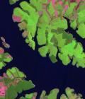
The experiment consisted to modify slightly the orbit of the Spot 4 satellite at the end of its life so as to simulate the 5 days repetitiveness of the future Sentinel-2 data from ESA. Images of Spot 4 have been acquired with such characteristics on 42 sites from February to June 2013.

More information: 

More news

AlTiS-NG GUI with Jason-2 mission on the Komadugu river, Niger

AlTiS-NG: A new tool for analysing altimetry data in hydrology

Discover AlTiS-NG, THEIA new hydrological altimetry software presented on Tuesday 24 June on the Data Terra stand at the LPS.

Data Terra, a major data player, awaits you at the Living Planet Symposium 2025

Join Data Terra at the heart of innovation at the Living Planet Symposium 2025! From June 23 to 27 in Vienna.

Engineer in remote sensing applied to monitoring tropical forest ecosystems

The INRAE offers a remote-sensing engineer position in TETIS laboratory, Montpellier, France.

Search