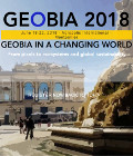
Geobia’18 in France
The 7th edition of Geobia, the Geographic Object-Based Image Analysis, will take place in Montpellier (south of France) the 19 to the 23 of June.
GEOBIA’18 should bring together scientists, professionals and users, academia, industry, the public sector and government around the world.
GEOBIA’18 will continue to be a platform for pre-senting research and development on traditional themes: theory / concepts, methods / algorithms and OBIA applications.
Particular attention will be given to the current challenges of large data integration, open source solutions, Cloud analysis, semantics and knowledge integration.
Promoting the event towards our colleagues from the South, 2018 GEOBIA will offer an opportunity for exchange and collaboration perspectives for various global Earth issues facing climate change impacts. South and North teams would find during this session the opportunity to present their work regarding worldwide challenges such as agro-system, forestry and natural resources monitoring, food security or crop yield modelling, risks management or urban applications (densification, Landuse-Landover change processes …).
See more : geobia2018.com
More information: Biodiversity


