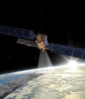
Sentinel-1B on its way to complete Europe´s “Radar Vision”
Copernicus satellite Sentinel-1B , successfully launched on April 26 2016, will monitor the environment around the clock in all weathers thanks to C-Band radars.
The 2.3 tonne satellite lifted off on a Soyuz rocket from Europe’s Spaceport in Kourou, French Guiana at 21:02 GMT (23:02 CEST). The satellite separated from the upper stage about 24 min. after liftoff.
Once activated, it will operate jointly with its twin, Sentinel-1A (launched in April 2014) and form the Sentinel-1 polar orbiting constellation, which will significantly improve revisit and response times to provide continuous all-weather round the clock imagery for marine, land monitoring and emergency services. Working together, the Sentinel-1 satellites will image the entire planet every six days.
As an advanced radar mission, Sentinel-1 can image the Earth’s surface through cloud and rain and regardless of whether it is day or night. This makes it an ideal mission, for example, for monitoring the polar regions, which are in darkness during the winter months and tropical forests, which are typically shrouded by cloud.
Over land, Sentinel-1’s systematic observations are used to track changes in the way the land is used and to monitor ground movement with exceptional accuracy. Moreover, this mission is designed specifically to aid fast response during emergencies and disasters such as flooding and earthquakes.
Sentinel-1B is the fourth in a series of Sentinel satellites for the European Copernicus programme, a joint project of the European Commission and the European Space Agency (ESA).


