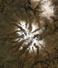
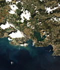
Spot 5 (Take5) first image

The first set of Spot5 (Take5) images was acquired on the 8th of April 2015 in Uganda.

Lake Victoria and Sigulu Island are part of the first set of images processed by Airbus Defence and Space at Level 1A. It is the proof that everything went well at all stages, from programming to acquisition and processing, despite the fact that Spot5 is not on its nominal orbit anymore.

This image will be followed by 29 more images on this site, acquired with a periodicity of five days. And the same will happen on 149 other sites.

More information on : https://www.cesbio.cnrs.fr/multitemp/?p=4938
More information: 

More news

AlTiS-NG GUI with Jason-2 mission on the Komadugu river, Niger

AlTiS-NG: A new tool for analysing altimetry data in hydrology

Discover AlTiS-NG, THEIA new hydrological altimetry software presented on Tuesday 24 June on the Data Terra stand at the LPS.

Data Terra, a major data player, awaits you at the Living Planet Symposium 2025

Join Data Terra at the heart of innovation at the Living Planet Symposium 2025! From June 23 to 27 in Vienna.

Engineer in remote sensing applied to monitoring tropical forest ecosystems

The INRAE offers a remote-sensing engineer position in TETIS laboratory, Montpellier, France.

Search