Gabon Biomass Map
A Gabon biomass map with a 50x50m resolution.
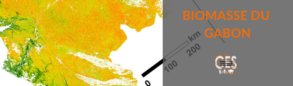
A Gabon biomass map with a 50x50m resolution.
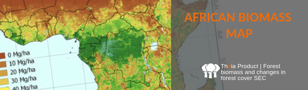
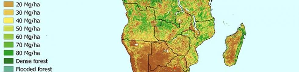
Above-ground biomass map of of the savannahs and woodlands of continental Africa and Madagascar at a resolution of 50m x 50m.
Data access Presentation This biomass map has a spatial resolution of 250m x 250m and was obtained using the data fusion of LiDAR, optical and other climatic datasets. The precision […]
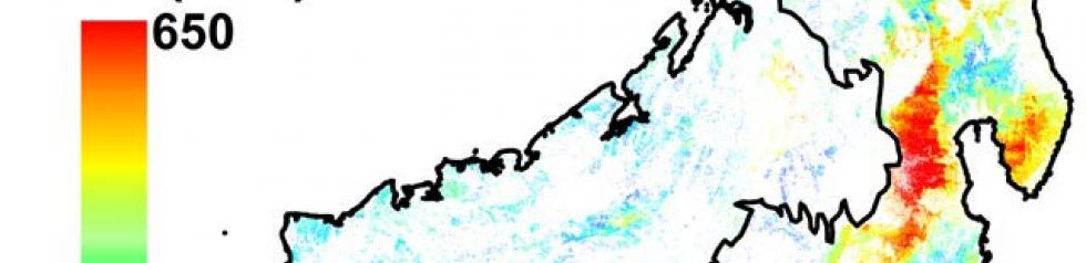
Biomass map for French Guiana obtained using the data fusion of LiDAR, radar, optical and other environmental datasets.
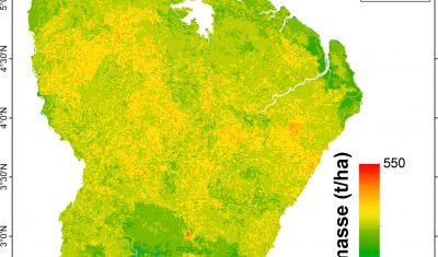
Mapping of above-ground biomass (in tonnes/ha) of forests as well as changes in forest cover following deforestation and forest degradation