FAO-Google partnership : remote sensing data more efficient and accessible
The Food and Agriculture Organization of the United Nations(FAO) and Google Maps have concluded a partnership to make geospatial tracking and mapping products more accessible.
Google Maps and FAO have agreed to provide a high-technology assist to countries tackling climate change and much greater capacity to experts developing forest and land-use policies.
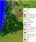
Digital technology tapping into satellite imagery is revolutionizing the way countries can assess, monitor and plan the use of their natural resources, including monitoring deforestation and desertification.
The three-year partnership between Google Maps and FAO is designed to foster innovation and expertise and sharply broaden access to easy-to-use digital tools. It ushers in a major ramping up of existing collaboration between the two organizations and will boost the visibility and implementation of efforts to encourage sustainable environmental practices around the world.
More information on : www.fao.org
