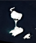
More than 20 000 Sentinel-2 products
The number of Sentinel-2A Level2A products just passed the 20000 milestone, with the complete collection of French oversea regions, and new sites along the Ganges, Brahmaputra and Mekong rivers.
News
The number of Sentinel-2A Level2A products just passed the 20000 milestone, with the complete collection of French oversea regions, and new sites along the Ganges, Brahmaputra and Mekong rivers.
Publications
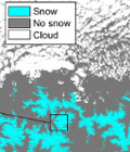
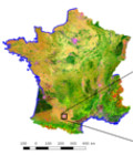
Theia releases since June 2017 a new 20 m resolution product which indicates the snow presence or absence on the land surface every fifth day if there is no cloud.
News
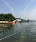
A campaign is taking place on 22 and 23 June 2017 in the lower Seine valley with different sensors using several techniques to prepare Swot data validation in the future.

Agenda
The Labex CEBA is organising its thematic school on remote sensing and its potential uses in the study of biodiversity. It will be held at the Hotel des Roches in Kourou (French Guiana) as from the 25th to the 29th of September 2017.
Infrastructure
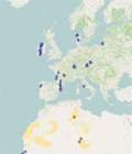
Here are the sites that will be observed by the long awaited French-Israeli satellite Venµs.
Agenda
The third OTB users days will be held in Toulouse, June 7-9 2017.
News
The Theia Muscate production center distributes new level 2A Landsat 8 products acquired from March 1st to 31th 2017 in France and in the French overseas territories.
News
The number of L2A products from Sentinel-2 available at Theia, just passed above 10000.
News
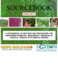
« Sourcebook of Methods and Procedures for Monitoring Essential Biodiversity Variables in Tropical Forests with Remote Sensing » published by Global Observation of Forest Cover and Land Dynamics (GOFC-GOLD) is available for download.

News
A call for papers is open until the 30th of September 2017 for the Remote Sensing Journal « Special Issue: Science and Applications with Sentinel-2 ».
News
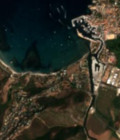
The production of Sentinel-2 L2A products nears real time, and L2A products acquired until March 2017 over France and Reunion Island have started to appear on the distribution server.
News
The first land cover classification map of Metropolitan France for 2016 made from Sentinel-2 data at 10m resolution was released by the Land cover Scientific Expertise Centre on the 30th of March 2017.